Portal:Maps/Selected biography
| This Wikipedia page has been superseded by Portal:Maps and is retained primarily for historical reference. |
| Note: Did you know entries are now being transcluded directly on the main portal page. However, this page should be retained for historical reference. |
Selected biography 1
Portal:Maps/Selected biography/1

Claudius Ptolemaeus (Greek: Κλαύδιος Πτολεμαῖος; c. AD 90 – c. 168), known in English as Ptolemy, was a Greek-speaking geographer, astronomer, and astrologer who lived in the Hellenistic culture of Roman Egypt. He may have been a Hellenized Egyptian but no description of his family background or physical appearance exists, though it is likely he was born in Egypt.
Ptolemy was the author of several scientific treatises, three of which have been of continuing importance to later Islamic and European science. The first is the astronomical treatise that is now known as the Almagest ("The Great Treatise"). The second is the Geography, which is a thorough discussion of the geographic knowledge of the Greco-Roman world. The third is the astrological treatise known as the Tetrabiblos ("Four books") in which he attempted to adapt horoscopic astrology to the Aristotelian natural philosophy of his day. (read more...)
Selected biography 2
Portal:Maps/Selected biography/2

Su Song (1020–1101 AD) was a renowned Chinese statesman, astronomer, cartographer, horologist, pharmacologist, mineralogist, zoologist, botanist, mechanical and architectural engineer, and ambassador of the Song Dynasty.
Su Song was the engineer of a water-driven astronomical clock tower in medieval Kaifeng depicted in his horological treatise, Xin Yi Xiang Fa Yao, which employed the use of an early escapement mechanism, armillary sphere and the oldest known endless power-transmitting chain drive, called the tian ti, or "celestial ladder". He also completed a large celestial atlas of several star maps, several terrestrial maps, as well as a treatise on pharmacology.
Selected biography 3
Portal:Maps/Selected biography/3
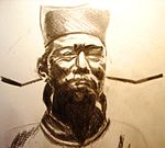
Shen Kuo or Shen Kua (1031–1095) was a polymath Chinese scientist and statesman of the Song Dynasty. He excelled in many fields of study and statecraft, imcluding; mathematician, astronomer, geologist, zoologist, encyclopedist, poet and diplomat, among many others.
In his Dream Pool Essays of 1088, Shen was the first to describe the magnetic needle compass, which would be used for navigation. Kuo also discovered the concept of true north in terms of magnetic declination towards the North Pole. Alongside his colleague Wei Pu, Shen accurately mapped the orbital paths of the Moon and the planets, in an intensive five-year project that rivaled the later work of the Danish astronomer Tycho Brahe. To aid his work in astronomy, Shen Kuo made improved designs of the armillary sphere, gnomon, sighting tube, and invented a new type of inflow clepsydra clock.
Selected biography 4
Portal:Maps/Selected biography/4

Abu Abd Allah Muhammad al-Idrisi (1100–1165 or 1166) was an Arab cartographer, geographer and traveller who lived in Sicily, at the court of King Roger II. Muhammad al-Idrisi was born in Ceuta and died in Sicily, or maybe in Ceuta. Al Idrisi claimed that he was a direct descendant of the prophet Muhammad.
Al-Idrisi's best known work is his map of the world "lawh al-tarsim" (plank of draught), of 1154. He worked on the commentaries and illustrations for eighteen years at the court of King Roger II of Sicily. His map is now known as the 'Tabula Rogeriana', his book as the Geografia. His maps were used extensively during the explorations of the era of the Renaissance like the journeys of Christopher Columbus.
Selected biography 5
Portal:Maps/Selected biography/5

Saint Isidore of Seville (c. 560 – April 4, 636) was Archbishop of Seville for more than three decades and has the reputation of being one of the great scholars of the early Middle Ages. All the later medieval history-writing of Hispania were based on his histories.
Isidore taught in the Etymologiae that the Earth was round. His meaning was ambiguous and some writers think he referred to a disc-shaped Earth; his other writings make it clear, however, that he considered the Earth to be globular. Isidore's disc-shaped analogy continued to be used through the Middle Ages by authors clearly favouring a spherical Earth, e.g. the 9th century bishop Rabanus Maurus who compared the habitable part of the northern hemisphere (Aristotle's northern temperate clime) with a wheel, imagined as a slice of the whole sphere.
Selected biography 6
Portal:Maps/Selected biography/6

Hipparchus (ca. 190 BC – ca. 120 BC) was a Greek astronomer, geographer, and mathematician of the Hellenistic period.
Hipparchus was born in Nicaea (now Iznik, Turkey), and probably died on the island of Rhodes. He is known to have been a working astronomer at least from 147 BC to 127 BC. Hipparchus is considered the greatest astronomical observer and, by some, the greatest overall astronomer of antiquity. He was the first Greek to develop quantitative and accurate models for the motion of the Sun and Moon. With his solar and lunar theories and his numerical trigonometry, he was probably the first to develop a reliable method to predict solar eclipses. His other achievements include the discovery of precession, the compilation of the first star catalogue of the western world, and, probably, the invention of the astrolabe.
Selected biography 7
Portal:Maps/Selected biography/7

Eratosthenes of Cyrene (276 BC - 194 BC) was a Greek mathematician, poet, athlete, geographer and astronomer. His contemporaries nicknamed him "beta" because he supposedly proved himself to be the second in the ancient Mediterranean region in many fields. He is noted for devising a system of latitude and longitude, and for being the first known to have calculated the circumference of the Earth. He also created a map of the world based on the available geographical knowledge of the era.
Eratosthenes studied in Alexandria and claimed to have done so for some years in Athens. In 236 BC he was appointed by Ptolemy III Euergetes I as librarian of the Alexandrian library, succeeding the first librarian, Zenodotos, in that post. He made several important contributions to mathematics and science, and was a good friend to Archimedes. Around 255 BC he invented the armillary sphere, which was widely used until the invention of the orrery in the 18th century.
Selected biography 8
Portal:Maps/Selected biography/8

Anaximander (c. 610 BC–c. 546 BC) was a pre-Socratic philosopher who lived in Miletus, a city of Ionia. He joined the Milesian school and studied the teachings of its master Thales. He succeeded him and became the second master of that school where he counted Anaximenes and Pythagoras amongst his pupils.
Anaximander was one of the earliest Greek thinkers at the start of the Axial Age. He was an early proponent of science and tried to observe and explain different aspects of the universe, with a particular interest in its origins, claiming that nature is ruled by laws. In astronomy, he tried to describe the mechanics of celestial bodies in relation to the Earth. In physics, he postulated that the indefinite (or apeiron) was the source of all things. He created a map of the world that contributed greatly to the advancement of geography. He was also involved in the politics of Miletus as he was sent as a leader to one of its colonies.
Selected biography 9
Portal:Maps/Selected biography/9
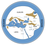
Hecataeus (c. 550 BC–c. 476 BC), named after goddess Hecate, was a Greek philosopher, and a native of Miletus. He flourished during the time of the Persian invasion. After having travelled extensively, he settled in his native city, where he occupied a high position, and devoted his time to the composition of geographical and historical works. Hecataeus is the first known Greek historian, and was one of the first classical writers to mention the Celtic people.
Some have credited Hecataeus with a work entitled Ges Periodos ("Travels round the Earth" or "World Survey"), a point-to-point coastal survey. One on Europe, is essentially a periplus of the Mediterranean, reaching as far north as Scythia. The other book, on Asia, is arranged similarly to the Periplus of the Erythraean Sea of which a version of the 1st century CE survives. The descriptive matter was accompanied by a map, based upon Anaximander’s map of the earth.
Selected biography 10
Portal:Maps/Selected biography/10

Björn Gunnlaugsson (September 25, 1788 – March 17, 1876) was an Icelandic mathematician and cartographer. The only studied mathematician in Iceland in the 19th century, Björn was isolated from the academic community in Europe, and the intellectual environment made him turn to the didactics and the applications of mathematics, and also to philosophy.
For the Literary Society of Iceland, he surveyed the country from 1831 to 1843. The results of his work were published in a topographic map of Iceland at a scale of 1:480,000 on four sheets. It was the first complete map of Iceland and was published under the direction of Olaf Nikolas Olsen in Copenhagen. For his survey work, Björn received the Order of the Dannebrog in 1846 and the French Légion d'honneur in 1859.
Selected biography 11
Portal:Maps/Selected biography/11

Matthew Fontaine Maury (January 14, 1806 – February 1, 1873), USN - American astronomer, astrophysicist, historian, oceanographer, meteorologist, cartographer, author, geologist, educator.
He was nicknamed Pathfinder of the Seas and Father of modern Oceanography and Naval Meteorology and later, Scientist of the Seas, due to the publication of his extensive works in his books, especially Physical Geography of the Sea 1855, the first extensive and comprehensive book on oceanography to be published. Maury made many important new contributions to charting winds and ocean currents, including pathways for ships at sea. Maury's work on ocean currents led him to advocate his theory of the Northwest Passage, as well as the hypothesis that an area in the ocean near the North Pole is occasionally free of ice.
Selected biography 12
Portal:Maps/Selected biography/12

Captain Matthew Flinders RN (16 March 1774 – 19 July 1814) was one of the most accomplished navigators and cartographers of his age. In a career that spanned just over twenty years, he sailed with Captain William Bligh, circumnavigated Australia and encouraged the use of that name for the continent, survived shipwreck and disaster only to be imprisoned as a spy, identified and corrected the effect of iron components and equipment on board wooden ships upon compass readings, and wrote the seminal work on Australian exploration A Voyage To Terra Australis.
Flinders' name is now associated with many geographical features and places in Australia in addition to Flinders Island, in Bass Strait. His proposal for the use of iron bars to be used to compensate for the magnetic deviations caused by iron on board a ship resulted in them being known as Flinders bars
Selected biography 13
Portal:Maps/Selected biography/13

Captain James Cook FRS RN (27 October 1728 (O.S.) – 14 February 1779) was an English explorer, navigator and cartographer. Ultimately rising to the rank of Captain in the Royal Navy, Cook was the first to map Newfoundland prior to making three voyages to the Pacific Ocean during which he achieved the first European contact with the eastern coastline of Australia, the European discovery of the Hawaiian Islands, and the first recorded circumnavigation of New Zealand.
Cook accurately charted many areas and recorded several islands and coastlines on Europeans' maps for the first time. His achievements can be attributed to a combination of seamanship, superior surveying and cartographic skills, courage in exploring dangerous locations to confirm the facts, an ability to lead men in adverse conditions, and boldness both with regard to the extent of his explorations and his willingness to exceed the instructions given to him by the Admiralty.
Selected biography 14
Portal:Maps/Selected biography/14
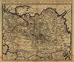
Nicolaes Witsen (8 May 1641 - 10 August 1717) was a Dutch diplomat, cartographer, writer and thirteenth mayor of Amsterdam between 1682-1706. He was a representative to the States-General, administrator of the VOC and extraordinary-ambassador extraordinaris to the English court. Witsen was an authority on shipbuilding and his books on the subject are important sources on Dutch shipbuilding in the 17th century.
Nicolaes Witsen was the son of Cornelis Jan Witsen, mayor of Amsterdam, head bailiff and administrator of the Dutch West India Company. Witsen published the first map of Siberia, and in 1692 a treatise titled "Noord en Oost Tartaryen", describing Siberia and the surrounding areas.
Selected biography 15
Portal:Maps/Selected biography/15

Abraham Ortelius (April 2, 1527 – June 28, 1598) was a cartographer and geographer, generally recognized as the creator of the first modern atlas. He was born in Antwerp in what is now Belgium, a member of the influential Ortelius family of Augsburg.
Beginning as a map-engraver, in 1547 he entered the Antwerp guild of St Luke as afsetter van Karten. His early career is that of a businessman, and most of his journeys before 1560 are for commercial purposes. In 1560, however, when travelling with Mercator to Trier, Lorraine and Poitiers, he seems to have been attracted, largely by Mercator’s influence, towards the career of a scientific geographer; in particular he now devoted himself, at his friend’s suggestion, to the compilation of that atlas, or Theatrum Orbis Terrarum (Theatre of the World), by which he became famous.
Selected biography 16
Portal:Maps/Selected biography/16
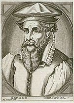
Gerardus Mercator (March 5, 1512 – December 2, 1594) was a Flemish cartographer. He was born in Rupelmonde in East Flanders to parents from Gangelt in the Duchy of Jülich. Born Gheert Cremer, "Mercator" is the Latinized form of his name meaning "merchant". He is remembered for the Mercator chart named after him.
Despite his fame as a cartographer, Mercator's main source of income came through his craftmanship of mathematical instruments. Mercator's own independent map-making only began when he produced a map of Palestine in 1537. Mercator devised a technique to produce globes, celestial as well as terrestrial, by techniques of relative mass production. Twenty-two such pairs of Mercator globes have survived.
Selected biography 17
Portal:Maps/Selected biography/17
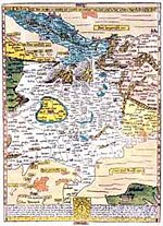
Erhard Etzlaub, was an astronomer, geodesist, cartographer, instrument maker and physician. From letters from a third party dated 1500 and 1507, we learn that he was a well-known instrument ("compass") maker and a geodesist, and from a letter dated 1517, that "he had also practicised as a physician for at least four years". His death is noted in as the 15th entry in an official list of 20 people buried between December 20, 1531 and February 21, 1532.
On occasion of the Holy Year 1500, when many pilgrims were expected to go to Rome, he designed his famous "Rom-Weg" map, a 41 x 29 cm wood engraving in stereographic projection of app. scale 1:5,6 mio., the earliest printed road map of central Europe. It is, as all of Etzlaub's maps, "South-up". Distances between cities can be computed by dotted lines, where a one-dot-step means one German Mile (7400m). If the prints were coloured, they show political regions, too.
Selected biography 18
Portal:Maps/Selected biography/18
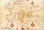
Piri Reis (full name Hadji Muhiddin Piri Ibn Hadji Mehmed) was an Ottoman-Turkish admiral and cartographer born between 1465 and 1470 in Gallipoli on the Aegean coast of Turkey.
He is primarily known today for his maps and charts collected in his Kitab-ı Bahriye (Book of Navigation), a book which contains detailed information on navigation as well as extremely accurate charts describing the important ports and cities of the Mediterranean Sea. He gained fame as a cartographer when a small part of his first world map (prepared in 1513) was discovered in 1929 at Topkapı Palace in Istanbul. The most surprising aspect was the presence of the Americas on an Ottoman map, making it the first Turkish map ever drawn of the Americas.
Selected biography 19
Portal:Maps/Selected biography/19

Johannes Ruysch was an explorer, cartographer, astronomer, manuscript illustrator and painter from the Low Countries who produced a famous map of the world: the second oldest known printed representation of the New World. This Ruysch map was published and widely distributed in 1507.
In old documents Ruysch was sometimes called a Fleming or German, but he was likely born in Utrecht in the current Netherlands. It is thought that he accompanied John Cabot on his expedition to North America in 1497 and 1498. Ruysch's 1507 map of the world was included in the 1507 and 1508 southern editions of Ptolemy's Geographia, an atlas published in Rome.
Selected biography 20
Portal:Maps/Selected biography/20

Amerigo Vespucci (March 9, 1454 - February 22, 1512) was an Italian merchant, explorer and cartographer. He played a senior role in two voyages which explored the east coast of South America between 1499 and 1502. On the second of these voyages he discovered that South America extended much further south than before known by the Europeans. This convinced him that this land was part of a new continent.
Vespucci's voyages became widely known in Europe after two accounts attributed to him were published between 1502 and 1504. In 1507, Martin Waldseemüller produced a world map on which he named the new continent "America" after Vespucci's first name, Amerigo. In an accompanying book, Waldseemüller published one of the Vespucci accounts, which led to criticism that Vespucci was trying to usurp Christopher Columbus's glory.
Selected biography 21
Portal:Maps/Selected biography/21
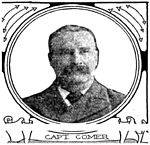
Captain George Comer (April 1858 – 1937) was considered the most famous American whaling captain of Hudson Bay, and the world's foremost authority on Hudson Bay Inuit in the early 20th century.
Comer was a polar explorer, whaler/sealer, ethnologist, cartographer, author, and photographer. He made 14 Arctic and three Antarctic voyages in his lifetime. These expeditions (ca. 1875-1919) commonly began in New London, Connecticut or New Bedford, Massachusetts. Comer's circle of friends and colleagues included other notable explorers of the time, such as Robert Peary and Capt. Frederick Cook, and his mentor, Franz Boas, the "Father of American Anthropology".
Selected biography 22
Portal:Maps/Selected biography/22
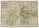
Edward Wright was an English mathematician and cartographer noted for his book Certaine Errors in Navigation, which for the first time explained the mathematical basis of the Mercator projection, and set out a reference table giving the linear scale multiplication factor as a function of latitude, calculated for each minute of arc up to a latitude of 75°. This was the essential step needed to make practical both the making and the navigational use of Mercator charts.
Wright was educated at the University of Cambridge, and was subsequently a fellow of Gonville and Caius College between 1587 and 1596. In 1589 the College granted him leave after Elizabeth I requested that he carry out navigational studies with a raiding expedition organised by the Earl of Cumberland to the Azores to capture Spanish galleons. The same year, Wright created and published the first world map produced in England and the first to use the Mercator projection since Gerardus Mercator's original 1569 map.
Selected biography 23
Portal:Maps/Selected biography/23
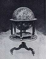
Emery Molyneux was an Elizabethan maker of globes, mathematical instruments and ordnance. His terrestrial and celestial globes, first published in 1592, were the first to be made in England and the first to be made by an Englishman.
Molyneux was known as a mathematician and maker of mathematical instruments such as compasses and hourglasses. John Davis probably introduced Molyneux to his patron who largely financed the construction of the globes. When completed, the globes were presented to Elizabeth I. Larger globes were acquired by royalty, noblemen and academic institutions, while smaller ones were purchased as practical navigation aids for sailors and students. The globes were the first to be made in such a way that they were unaffected by the humidity at sea, and they came into general use on ships.
