Qarwaqucha (Junín)
Appearance
| Qarwaqucha | |
|---|---|
| Location | Junín Region |
| Coordinates | 11°56′40″S 75°57′52″W / 11.94444°S 75.96444°W |
| Basin countries | Peru |
| Qarwaqucha Dam | |
|---|---|
| Dam and spillways | |
| Height | 12 m (39 ft) |
| Power Station | |
| Operator(s) | Electroperú S.A. |
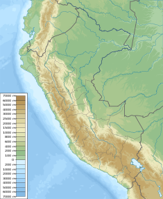
Qarwaqucha (Quechua qarwa yellowish, qucha lake,[1][2] hispanicized spelling Carhuacocha) is a lake in Peru located in the Junín Region, Jauja Province, Canchayllo District. It lies southeast of the peaks of Tunshu and Tukumach'ay and west of a lake named Wayllakancha (Huayllacancha). It belongs to the watershed of the Mantaro River.[3][4]
The Qarwaqucha dam was built in 1995. It is 12 m (13 yd) high. It was constructed by GUICONSA and is operated by Electroperú S.A.[5]
See also
[edit]References
[edit]- ^ "Diccionario: Quechua - Español - Quechua, Simi Taqe: Qheswa - Español - Qheswa" (PDF). Diccionario Quechua - Español - Quechua. Gobierno Regional del Cusco, Perú: Academía Mayor de la Lengua Quechua. 2005.
- ^ "Diccionario: Quechua - Español - Quechua, Simi Taqe: Qheswa - Español - Qheswa" (PDF). Diccionario Quechua - Español - Quechua. Gobierno Regional del Cusco, Perú: Academía Mayor de la Lengua Quechua. 2005.
- ^ blogspot.com Map of the area
- ^ escale.minedu.gob.pe - UGEL map of the Jauja Province (Junín Region) showing Qarwaqucha (unnamed) southeast of Tukumach'ay
- ^ Recursos Hídricos del Perú en Cifras, Boletín Técnico de Recursos Hídricos 2010, Autoridad Nacional del Agua, Ministerio de Agricultura, Peru


