São Francisco Bay
Appearance
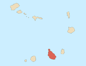
The São Francisco Bay (Portuguese: Baía de São Francisco, also Porto de São Francisco) is a bay on the southeastern coast of the island of Santiago, Cape Verde. It is situated 8 km northeast of the city centre of Praia, the capital of Cape Verde. The bay was mentioned in the 1747 map by Jacques-Nicolas Bellin as "St. Francisco".[1]
References
[edit]- ^ Jacques-Nicolas Bellin (1747). "Carte des Isles du Cap Verd = Kaart van de Eilanden van Kabo Verde" (in French).


