Sabine National Forest
| Sabine National Forest | |
|---|---|
 | |
| Location | Texas, U.S. |
| Nearest city | Hemphill, TX |
| Coordinates | 31°20′27″N 93°50′32″W / 31.34083°N 93.84222°W |
| Area | 160,873 acres (651.03 km2)[1] |
| Established | October 13, 1936[2] |
| Governing body | U.S. Forest Service |
| Website | Sabine National Forest |
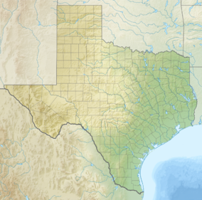
Sabine National Forest is located in East Texas near the Texas-Louisiana border. The forest is administered together with the other three United States National Forests and two National Grasslands located entirely in Texas, from common offices in Lufkin, Texas. There are local ranger district offices located in Hemphill.
The forest covers a total of 160,873 acres (651.03 km2) in five counties - Sabine (95,410 acres), Shelby (59,037 acres), San Augustine (4,317 acres), Newton (1,781 acres), and Jasper (64 acres). It includes the officially designated Indian Mounds Wilderness, which is a part of the National Wilderness Preservation System.
The Sabine National Forest is notable for extensive forests of American beech and other hardwood trees. Other important tree species include loblolly pine, longleaf pine, shortleaf pine, white oak, southern red oak, sweetgum, and Florida maple.
The Civilian Conservation Corps (CCC) helped the Texas Forest Service develop the forest between 1933 and 1940. CCC Company 893 established camp near Pineland, Texas on June 14, 1933, and planted pine seedlings in the southern part of the forest. These men also built roads and fire lookout towers and completed the Red Hills Lake Recreation Area near Toledo Bend Reservoir. CCC Company 880 established camp near Center, Texas on October 26, 1933, and planted thousands of pine trees in an area that became the northern part of Sabine National Forest. The CCC built the Boles Field Campground, including a pavilion and amphitheater, in the forest near Shelbyville, Texas.
See also
[edit]References
[edit]- ^ "Land Areas of the National Forest System" (PDF). U.S. Forest Service. January 2012. Retrieved June 30, 2012.
- ^ "The National Forests of the United States" (PDF). ForestHistory.org. Archived from the original (PDF) on October 28, 2012. Retrieved July 30, 2012.
External links
[edit]- National Forests and Grasslands in Texas - U.S. Forest Service
- Sabine National Forest from the Handbook of Texas Online
 Media related to Sabine National Forest at Wikimedia Commons


