Santa Eugènia, Mallorca
Appearance
Santa Eugènia | |
|---|---|
 | |
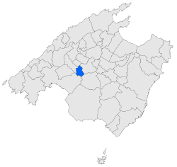
 Map of Santa Eugènia in Mallorca | |
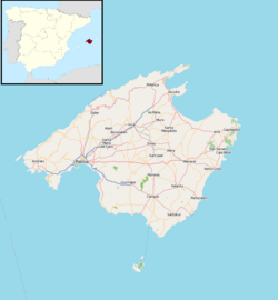
| Coordinates: 39°37′25″N 2°50′21″E / 39.62361°N 2.83917°E | |
| Country | Spain |
| Autonomous community | Balearic Islands |
| Province | Balearic Islands |
| Comarca | Pla de Mallorca |
| Judicial district | Palma de Mallorca |
| Government | |
| • Mayor | Guillem Crespí Sastre |
| Area | |
• Total | 20.25 km2 (7.82 sq mi) |
| Elevation | 149 m (489 ft) |
| Population (2018)[1] | |
• Total | 1,671 |
| • Density | 83/km2 (210/sq mi) |
| Demonym | Taujà |
| Time zone | UTC+1 (CET) |
| • Summer (DST) | UTC+2 (CEST) |
| Postal code | 07142 |
| Website | Official website |
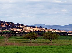
Santa Eugènia (Catalan pronunciation: [səntəwˈʒɛ.ni(ə)]) is a small municipality in the comarca of Pla de Mallorca on Majorca, one of the Balearic Islands, Spain.
Named after Saint Eugenia of Rome.
History
[edit]In prehistoric times, the area was settled by the Talaiotic Culture.
After the Moorish conquest of Iberia, it was ruled by the Berber Zenata people, until it was captured by King James I of Aragon in 1229.
References
[edit]- ^ Municipal Register of Spain 2018. National Statistics Institute.


