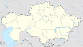
Saryshaghan
This article needs additional citations for verification. (February 2022) |
Saryshaghan
kaz. Сарышаған, Saryşağan Saryşağan | |
|---|---|
| Coordinates: 46°07′N 73°37′E / 46.117°N 73.617°E | |
| Country | Kazakhstan |
| Region | Karaganda Region |
| Founded | 1956 |
| • Summer (DST) | UTC+6 (UTC+6) |
| Postal code | 100314 |
Saryshaghan (Kazakh: Сарышаған, Saryşağan) is a town in Kazakhstan located on the coast of Lake Balkhash at Latitude (DMS): 46° 7' 9 N Longitude (DMS): 73° 37' 9 E in Karaganda Region. Its population is estimated at 11,000 inhabitants.
Sary Shagan is a site of the major antiballistic missile defense test range in the Soviet Union.[1] The first nonnuclear intercept of a ballistic missile warhead by a missile was accomplished there on 4 March 1961.
History
[edit]On July 16, 1954, by the Decree of the Presidium of the Supreme Council of the Kazakh SSR, the Sary-Shagan village council was formed as part of the Shet District with its center in the settlement at the Sary-Shagan railway station, including settlements at the Kara-Zhingil and Naualy railway stations and transferring the village council to the administrative subordination to the Balkhash City Council.
Since 1956 - an urban-type settlement.[2]
Climate
[edit]Saryshaghan has a cold desert climate (Köppen: BWk)[3] with very cold winters and hot summers.
| Climate data for Saryshagan (1991–2020) | |||||||||||||
|---|---|---|---|---|---|---|---|---|---|---|---|---|---|
| Month | Jan | Feb | Mar | Apr | May | Jun | Jul | Aug | Sep | Oct | Nov | Dec | Year |
| Mean daily maximum °C (°F) | −8.6 (16.5) |
−6.0 (21.2) |
2.7 (36.9) |
15.3 (59.5) |
23.1 (73.6) |
29.1 (84.4) |
30.5 (86.9) |
28.8 (83.8) |
21.9 (71.4) |
13.3 (55.9) |
3.3 (37.9) |
−5.0 (23.0) |
12.4 (54.3) |
| Daily mean °C (°F) | −12.7 (9.1) |
−10.7 (12.7) |
−2.1 (28.2) |
9.5 (49.1) |
17.2 (63.0) |
23.2 (73.8) |
24.9 (76.8) |
23.0 (73.4) |
16.1 (61.0) |
7.9 (46.2) |
−1.0 (30.2) |
−9.0 (15.8) |
7.2 (45.0) |
| Mean daily minimum °C (°F) | −16.6 (2.1) |
−14.9 (5.2) |
−6.1 (21.0) |
4.5 (40.1) |
11.4 (52.5) |
17.2 (63.0) |
19.0 (66.2) |
17.0 (62.6) |
10.1 (50.2) |
2.8 (37.0) |
−4.8 (23.4) |
−12.6 (9.3) |
2.2 (36.0) |
| Average precipitation mm (inches) | 12.9 (0.51) |
10.2 (0.40) |
12.1 (0.48) |
13.4 (0.53) |
13.5 (0.53) |
14.0 (0.55) |
13.6 (0.54) |
7.9 (0.31) |
3.9 (0.15) |
7.9 (0.31) |
13.8 (0.54) |
11.5 (0.45) |
134.7 (5.30) |
| Average precipitation days (≥ 1.0 mm) | 4.1 | 3.3 | 3.3 | 3.1 | 3.0 | 2.7 | 3.2 | 1.8 | 1.2 | 2.1 | 3.7 | 3.9 | 35.4 |
| Source: NOAA[4] | |||||||||||||
References
[edit]- ^ Buyers, Lydia M. (2003). Central Asia in Focus: Political and Economic Issues. Nova Publishers. p. 93. ISBN 978-1-59033-153-8.
- ^ Ведомости Верховного Совета СССР. № 11 (853), 1956 г.
- ^ "Table 1 Overview of the Köppen-Geiger climate classes including the defining criteria". Nature: Scientific Data.
- ^ "World Meteorological Organization Climate Normals for 1991-2020 — Saryshagan". National Oceanic and Atmospheric Administration. Retrieved January 18, 2024.

