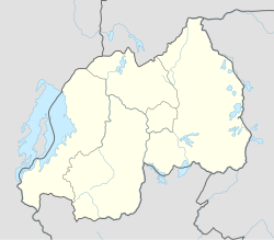
Save, Rwanda
Save | |
|---|---|
Town and sector | |
 The Catholic Church in Save | |
| Coordinates: 2°32′46″S 29°46′20″E / 2.546059°S 29.772134°E | |
| Country | |
| Province | Southern Province |
| District | Gisagara |
| Area | |
• Town and sector | 41.08 km2 (15.86 sq mi) |
| Population (2022 census)[1] | |
• Town and sector | 30,941 |
| • Density | 750/km2 (2,000/sq mi) |
| • Urban | 5,190 |
Save is a small town and sector in Rwanda. It is located a few miles north of the town of Butare, and in the west of the Gisagara District of Southern Province.[2] There is a church, several schools and a health centre. It is also home to the Mother House of the Benebikira Sisters.
German forces occupied Rwanda in 1897.[3] In 1899 Bishop John Joseph Hirth travelled to that country.[4] There he tried to develop a relationship with King Yuhi Musinga. Hirth gained permission to found the first Catholic missions in Rwanda at Save, Zaza and Nyundo between 1900 and 1901.[5] The first church in Rwanda was built at Save in 1900, a thatched structure. Later it was replaced by a brick building.[6]
References
[edit]Citations
- ^ Citypopulation.de Population and area of Save Sector
- ^ Gisagara Administrative Map.
- ^ Sundkler & Steed 2000, p. 597.
- ^ Adekunle 2007.
- ^ Adekunle 2007, p. 33.
- ^ The Church of the Holy Spirit.
Sources
- Adekunle, Julius (2007). Culture and Customs of Rwanda. Greenwood Publishing Group. ISBN 978-0-313-33177-0. Retrieved 26 March 2013.
- "Gisagara Administrative Map" (PDF). National Institute of Statistics of Rwanda. Retrieved 2013-04-02.
- Sundkler, Bengt G. M.; Steed, Christopher (2000). A History of the Church in Africa. Cambridge University Press. p. 597. ISBN 978-0-521-58342-8. Retrieved 26 March 2013.
- "The Church of the Holy Spirit of Save". Access Rwanda Safaris. Retrieved 2013-04-04.

