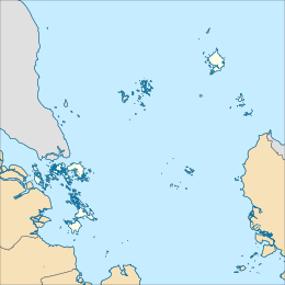
Serasan Island
Appearance
Native name: Pulau Serasan | |
|---|---|
 Serasan Harbor, southeast of the island | |
 A satellite image of Serasan Island and surrounding islands | |
| Geography | |
| Location | South China Sea |
| Coordinates | 2°30′45″N 109°03′33″E / 2.5125°N 109.059167°E |
| Archipelago | South Natuna |
| Area | 45.96 km2 (17.75 sq mi) |
| Highest elevation | 441 m (1447 ft) |
| Administration | |
| Province | Riau Islands |
| Regency | Natuna Islands |
| Largest settlement | Serasan |
| Demographics | |
| Ethnic groups | Malays |
| Additional information | |
| Time zone | |
Serasan Island is an island in the Natuna Regency, Riau Islands, Indonesia.[1] The island is split between two districts, the Serasan District is on the west side and Serasan Timur is on the east side. On March 6, 2023, heavy rainfall created landslides on the island, killing 15 and leaving many more missing.[2] The island hosts the critically endangered Natuna Islands Tarsier, which is endemic to the islands and whose population is declining rapidly.[3]
References
[edit]- ^ "GeoNames.org". www.geonames.org. Retrieved 2023-03-08.
- ^ "At least 15 killed in Indonesia landslide, dozens missing". www.aljazeera.com. Retrieved 2023-03-08.
- ^ Richardson, Matthew (2023-03-09). Threatened and Recently Extinct Vertebrates of the World: A Biogeographic Approach. Cambridge University Press. ISBN 978-1-108-85258-6.

