
Skåneleden
| Skåneleden | |
|---|---|
 Shelter along the trail, lake Grundsjön | |
| Length | 1,600 km (990 mi) |
| Location | Skåne, Sweden |
| Established | 1978 |
| Use | Hiking |
| Difficulty | Varied |
| Waymark | Orange square |
| Sights | Sofiero Palace, Hovdala Castle, Kullaberg, Söderåsen |
| Maintained by | Municipalities of Skåne County |
| Website | skaneleden |
The Skåneleden trail is a long-distance walking trail that stretches all over the beautiful countryside of Skåne, situated in the very south of Sweden. The trail is 1600 km long and divided into six separate trails, with a total of 144 sections. The trail can easily be recognized by the orange trail marks along the footpath. The trail runs from the west to east and from north to south and passes through a highly diversified landscape such as rocky coastlines, undulating ridges, deep forests and white sandy beaches. Parts of the trail are accessible by wheelchair.[1]
Throughout the trail, there are about 90 permanent shelters at camp sites. The trail is included in the 6,000-km long North Sea Trail, which passes through Sweden, Norway, Denmark, Germany, the Netherlands and the United Kingdom.
On behalf of Region Skåne, the Scanian Landscape Foundation manages the trail, including coordinating the municipal work and the contacting with visitors. The municipalities are in turn responsible for the maintenance of the trail[citation needed].
Sub-trails[edit]
The five separate segments are:
- Kust till kust (Coast to coast), 370 km (two divisions, East and West), stretching from Sölvesborg in the east to Ängelholm in the west.
- Nord till syd (North to south), 325 km (two divisions, North and South), stretching from Hårsjö (west of Vittsjö) in the north to Trelleborg in the south. The southern section passes through Dalby Söderskog, Skåne's smallest and oldest national park.
- Ås till ås (Ridge to ridge), 162 km – Stretching from Åstorp to Brösarp. This part of the trail runs through Söderåsen National Park – Skåne's largest national park.
- Österlen, 188 km, starting and ending in Ystad. Between the cities of Simrishamn and Kivik the trail passes through Stenshuvud National Park. The northern part of the trail passes through Brösarps slopes and Hallamölla waterfall.
- Öresund, 214 km, stretching from Utvälinge in the north to Trelleborg in the south, including a circular trail around the Falsterbonäset Peninsula. A small section in the south between Skåre and the Falsterbonäset Peninsula is yet to be completed.
- Vattenriket, 190 km, from Breanäs to Brösarp, passing Vattenriket in Kristianstad. It is the most recent addition to Skåneleden, inaugurated in May 2024.[2] The new segment incorporated the already existing hiking path Degebergaleden, passing through Forsakar nature reserve.[3]
Gallery[edit]
-
 Hammars backar hill
 -
 Signpost
 -
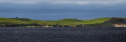 Hammars backar hills, seen from Ystad
 -
 Between Helsingborg and Rydebäck


External links[edit]
References[edit]
- ^ "Hiking on wheels in Skåne". Skåneleden. Retrieved 2019-08-05.
- ^ "Nu invigs SL6 Vattenriket". Skåneleden. Retrieved 2024-05-29.
- ^ "Degebergaleden blir Skåneleden". www.kristianstad.se (in Swedish). 2024-05-07. Retrieved 2024-05-29.