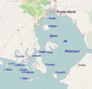
Tabon Island (Chile)
Appearance
This article relies largely or entirely on a single source. (September 2013) |
Native name: Isla Tabón | |
|---|---|
 Calbuco Archipelago South of Puerto Montt | |
 | |
| Administration | |
| Region | Los Lagos |
| Province | Llanquihue |
| Commune | Calbuco |
| Demographics | |
| Population | 350 (2008 US Hydrographic survey[1]) |
| Additional information | |
| NGA UFI -889086 | |
Tabon Island, or Isla Tabón, is part of the Calbuco Archipelago, located in Chile.
At high tide the water level covers the pebble ridges that connect the island's peaks, dividing it into three sub-islands: Lin, Ilto, and Polmalluelhe.
References
[edit]- ^ United States Hydrographic Office (2008). The Coasts of Chile, Bolivia, and Peru. BiblioBazaar. p. 90. ISBN 978-0-559-21778-4.
External links
[edit]41°54′30″S 73°06′53″W / 41.90845°S 73.114802°W
