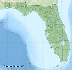
Telogia Creek
| Telogia Creek Tologic River | |
|---|---|
| Location | |
| Country | United States |
| State | Florida |
| Counties | Gadsden Liberty |
| Physical characteristics | |
| Source | |
| • coordinates | 30°38′41″N 84°41′06″W / 30.64472°N 84.68500°W |
| Mouth | Ochlockonee River |
• coordinates | 30°16′06″N 84°44′12″W / 30.26833°N 84.73667°W |
• elevation | 20 feet (6.1 m) |
Telogia Creek is a waterway in Florida. It is a major tributary of the Ochlockonee River.[1] It is used for canoeing.[2] The United States Geological Survey (USGS) monitors its discharge near Bristol.[3] The stream's water quality is monitored at a site near Greensboro.[4] Road crossings include the Telogia Creek Bridge.
Botanist Roland McMillan Harper identified several species in the area of the creek during his travels in Florida 1909–1910.[5]
The surrounding area includes horse properties.
There is a community of Telogia, a scouting Telogia Camp, and a Telogia Creek Road. Lampropeltis getula meansi, the Appalachicola Kingsnake, lives in the area. It is non-venomous.
Paddling
[edit]The creek can be accessed from the Bently Bluff ramp. Approximately 14 miles downstream (7 miles as the crow flies) it meets up with the Ochlockonee River. Huey P. Arnold County Park can be used as a takeout spot.[2]
The creek is windy, shuttling is necessary and there can be snags. Shorter warter craft are easier to maneuver along it.[2]
References
[edit]- ^ Light, Helen M.; Florida Dept. of Environmental Regulation; U.S. Geological Survey (1993). Hydrology, vegetation, and soils of four north Florida river flood plains with an evaluation of state and federal wetland determinations. U.S. Geological Survey. p. 20. OCLC 29815036.
- ^ a b c "Telogia Creek Paddle Information Sheet" (PDF). Florida Paddling Trails Association. Retrieved December 29, 2018 – via Amazon Web Services.
- ^ "USGS Current Conditions for USGS 02330100 TELOGIA CREEK NR BRISTOL, FLA". waterdata.usgs.gov.
- ^ "TELOGIA CREEK NR GREENSBORO, FLA. (USGS-02330050) site data in the". www.waterqualitydata.us.
- ^ Shores, Elizabeth Findley (2010). On Harper's Trail: Roland Mcmillan Harper, Pioneering Botanist of the Southern Coastal Plain. University of Georgia Press. p. 60. ISBN 978-0-820-33522-3.
- "Telogia Creek". Geographic Names Information System. United States Geological Survey, United States Department of the Interior. Retrieved December 25, 2018.


