Jump to content

英文维基 | 中文维基 | 日文维基 | 草榴社区

Template:Infobox mountain/testcases

Coordinates: 57°30′N 130°36′W / 57.5°N 130.6°W / 57.5; -130.6
From Wikipedia, the free encyclopedia

Testing map functionality

[edit]
Side by side comparison
{{Infobox mountain}}{{Infobox mountain/sandbox}}
Mount Hood
Mount Hood is located in Oregon
Mount Hood
Mount Hood
Uses location map
Mount Hood is located in the United States
Mount Hood
Mount Hood
In the USA
Highest point
Coordinates45°22′25″N 121°41′45″W / 45.373514°N 121.695918°W / 45.373514; -121.695918
Mount Hood
Mount Hood is located in Oregon
Mount Hood
Mount Hood
Uses location map
Mount Hood is located in the United States
Mount Hood
Mount Hood
In the USA
Highest point
Coordinates45°22′25″N 121°41′45″W / 45.373514°N 121.695918°W / 45.373514; -121.695918
Side by side comparison
{{Infobox mountain}}{{Infobox mountain/sandbox}}
Mount Hood
Uses image only
Highest point
Coordinates45°22′25″N 121°41′45″W / 45.373514°N 121.695918°W / 45.373514; -121.695918
Mount Hood
Uses image only
Highest point
Coordinates45°22′25″N 121°41′45″W / 45.373514°N 121.695918°W / 45.373514; -121.695918
Side by side comparison
{{Infobox mountain}}{{Infobox mountain/sandbox}}
K2
A large angular white mountain, with steeply sloped sides mostly covered with snow, dominates surrounding brown mountains
K2 in Summer
Highest point
Elevation8,611 m (28,251 ft) Ranked 2nd
Prominence4,017 m (13,179 ft)
Coordinates35°52′57″N 76°30′48″E / 35.88250°N 76.51333°E / 35.88250; 76.51333[1]
Geography
K2 is located on the far northwest border of Pakistan, next to China
K2
Location on Pakistan/China border
LocationTaxkorgan Tajik Autonomous County, Xinjiang, China/Northern Areas, Pakistan This is an example of a long line.
Parent rangeKarakoram
Climbing
First ascentJuly 31, 1954 by Lacedelli & Compagnoni
Easiest routeRock, snow and ice climb
K2
A large angular white mountain, with steeply sloped sides mostly covered with snow, dominates surrounding brown mountains
K2 in Summer
Highest point
Elevation8,611 m (28,251 ft) Ranked 2nd
Prominence4,017 m (13,179 ft)
Coordinates35°52′57″N 76°30′48″E / 35.88250°N 76.51333°E / 35.88250; 76.51333[1]
Geography
K2 is located on the far northwest border of Pakistan, next to China
K2
Location on Pakistan/China border
LocationTaxkorgan Tajik Autonomous County, Xinjiang, China/Northern Areas, Pakistan This is an example of a long line.
Parent rangeKarakoram
Climbing
First ascentJuly 31, 1954 by Lacedelli & Compagnoni
Easiest routeRock, snow and ice climb

Label is bold, grid ref note

Side by side comparison
{{Infobox mountain}}{{Infobox mountain/sandbox}}
Slieve Gallion
View from the eastern peak - 496 metres (1,627 ft)
Highest point
Elevation528 m (1,732 ft)
ListingMarilyn
Coordinates54°44′N 6°46′W / 54.73°N 6.76°W / 54.73; -6.76
Naming
English translationMountain of the heights
Language of nameIrish
Geography
OSI/OSNI gridH8188note
Topo mapOSNI Discoverer 13

photo and map_relief not specified

[edit]
Side by side comparison
{{Infobox mountain}}{{Infobox mountain/sandbox}}
Mount Everest
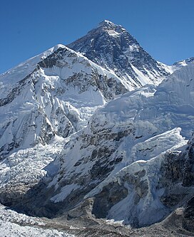
Everest from Kala Patthar in Nepal
Highest point
Elevation8,848 m (29,029 ft)
Prominence8,848 m (29,029 ft)
Notice special definition for Everest.
ListingSeven Summits
Eight-thousander
Country high point
Ultra
Coordinates27°59′17″N 86°55′31″E / 27.98806°N 86.92528°E / 27.98806; 86.92528
Naming
Native name
  • सगरमाथा (Sagarmāthā)
  • ཇོ་མོ་གླང་མ (Chomolungma)
  • 珠穆朗玛峰 (Zhūmùlǎngmǎ Fēng)
Geography
Mount Everest is located in Nepal
Mount Everest
Mount Everest
Location within Nepal on the Nepal–Tibet border
LocationNepal Sagarmatha Zone, Nepal
China Tibet, China
Parent rangeMahalangur Himal, Himalaya
Climbing
First ascent29 May 1953
New Zealand Edmund Hillary
Nepal Tenzing Norgay
Easiest routeSouth Col (Nepal)
Mount Everest
Everest from Kala Patthar in Nepal
Highest point
Elevation8,848 m (29,029 ft)
Prominence8,848 m (29,029 ft)
Notice special definition for Everest.
ListingSeven Summits
Eight-thousander
Country high point
Ultra
Coordinates27°59′17″N 86°55′31″E / 27.98806°N 86.92528°E / 27.98806; 86.92528
Naming
Native name
  • सगरमाथा (Sagarmāthā)
  • ཇོ་མོ་གླང་མ (Chomolungma)
  • 珠穆朗玛峰 (Zhūmùlǎngmǎ Fēng)
Geography
Mount Everest is located in Nepal
Mount Everest
Mount Everest
Location within Nepal on the Nepal–Tibet border
LocationNepal Sagarmatha Zone, Nepal
China Tibet, China
Parent rangeMahalangur Himal, Himalaya
Climbing
First ascent29 May 1953
New Zealand Edmund Hillary
Nepal Tenzing Norgay
Easiest routeSouth Col (Nepal)

relief=0

[edit]
Side by side comparison
{{Infobox mountain}}{{Infobox mountain/sandbox}}
Mount Everest
Mount Everest is located in Nepal
Mount Everest
Mount Everest
Location within Nepal on the Nepal–Tibet border
Highest point
Coordinates27°59′17″N 86°55′31″E / 27.98806°N 86.92528°E / 27.98806; 86.92528
Mount Everest
Mount Everest is located in Nepal
Mount Everest
Mount Everest
Location within Nepal on the Nepal–Tibet border
Highest point
Coordinates27°59′17″N 86°55′31″E / 27.98806°N 86.92528°E / 27.98806; 86.92528

map_relief=1 and no name

[edit]
Side by side comparison
{{Infobox mountain}}{{Infobox mountain/sandbox}}
Infobox mountain/testcases
Infobox mountain/testcases is located in Nepal
Infobox mountain/testcases
Location within Nepal on the Nepal–Tibet border
Highest point
Coordinates27°59′17″N 86°55′31″E / 27.98806°N 86.92528°E / 27.98806; 86.92528
Infobox mountain/testcases
Infobox mountain/testcases is located in Nepal
Infobox mountain/testcases
Location within Nepal on the Nepal–Tibet border
Highest point
Coordinates27°59′17″N 86°55′31″E / 27.98806°N 86.92528°E / 27.98806; 86.92528

map and image_map both

[edit]
Side by side comparison
{{Infobox mountain}}{{Infobox mountain/sandbox}}
Mount Everest
Mount Everest is located in Nepal
Mount Everest
Mount Everest
Location within Nepal on the Nepal–Tibet border
Relief map
Highest point
Coordinates27°59′17″N 86°55′31″E / 27.98806°N 86.92528°E / 27.98806; 86.92528
Mount Everest
Mount Everest is located in Nepal
Mount Everest
Mount Everest
Location within Nepal on the Nepal–Tibet border
Relief map
Highest point
Coordinates27°59′17″N 86°55′31″E / 27.98806°N 86.92528°E / 27.98806; 86.92528

photo, map and image_map

[edit]
Side by side comparison
{{Infobox mountain}}{{Infobox mountain/sandbox}}
Mount Everest
Everest from Kala Patthar in Nepal
Highest point
Coordinates27°59′17″N 86°55′31″E / 27.98806°N 86.92528°E / 27.98806; 86.92528
Geography
Mount Everest is located in Nepal
Mount Everest
Mount Everest
Location within Nepal on the Nepal–Tibet border
Relief map
Mount Everest
Everest from Kala Patthar in Nepal
Highest point
Coordinates27°59′17″N 86°55′31″E / 27.98806°N 86.92528°E / 27.98806; 86.92528
Geography
Mount Everest is located in Nepal
Mount Everest
Mount Everest
Location within Nepal on the Nepal–Tibet border
Relief map
Side by side comparison
{{Infobox mountain}}{{Infobox mountain/sandbox}}
Brienzer Rothorn
View from north
Highest point
Elevation2,351 m (7,713 ft)
Prominence1,339 m (4,393 ft)
ListingCanton high point
Coordinates46°47′N 8°02′E / 46.783°N 8.033°E / 46.783; 8.033
Geography
Brienzer Rothorn is located in Switzerland
Brienzer Rothorn
Brienzer Rothorn
Parent rangeBernese Alps
Climbing
Easiest routemountain train from Brienz
Brienzer Rothorn
View from north
Highest point
Elevation2,351 m (7,713 ft)
Prominence1,339 m (4,393 ft)
ListingCanton high point
Coordinates46°47′N 8°02′E / 46.783°N 8.033°E / 46.783; 8.033
Geography
Brienzer Rothorn is located in Switzerland
Brienzer Rothorn
Brienzer Rothorn
Parent rangeBernese Alps
Climbing
Easiest routemountain train from Brienz
Side by side comparison
{{Infobox mountain}}{{Infobox mountain/sandbox}}
Aira
姶良カルデラ
Space radar image of Aira Caldera, with Sakurajima in the bay formed by the caldera.
Highest point
Coordinates31°40′01″N 130°40′01″E / 31.667°N 130.667°E / 31.667; 130.667
Geography
Geology
Mountain types
Last eruptionc. 22,000 years ago
Aira
姶良カルデラ
Space radar image of Aira Caldera, with Sakurajima in the bay formed by the caldera.
Highest point
Coordinates31°40′01″N 130°40′01″E / 31.667°N 130.667°E / 31.667; 130.667
Geography
Geology
Mountain types
Last eruptionc. 22,000 years ago
Side by side comparison
{{Infobox mountain}}{{Infobox mountain/sandbox}}
Baintha Brakk
Baintha Camp near Snow Lake
Highest point
Elevation7,285 m (23,901 ft)
Prominence1,891 m (6,204 ft)
ListingUltra
Coordinates35°56′52″N 75°45′13″E / 35.94778°N 75.75361°E / 35.94778; 75.75361
Geography
Map
LocationPakistan
Parent rangePanmah Muztagh, Karakoram
Climbing
First ascentJuly 13, 1977 by Doug Scott and Chris Bonington
Easiest routesnow/ice climb

with map, mapframe and image map = infobox mapframe

[edit]
Side by side comparison
{{Infobox mountain}}{{Infobox mountain/sandbox}}
Baintha Brakk
Baintha Camp near Snow Lake
Highest point
Elevation7,285 m (23,901 ft)
Prominence1,891 m (6,204 ft)
ListingUltra
Coordinates35°56′52″N 75°45′13″E / 35.94778°N 75.75361°E / 35.94778; 75.75361
Geography
Baintha Brakk is located in Pakistan
Baintha Brakk
Baintha Brakk
Map
Map
Parent rangePanmah Muztagh, Karakoram
Climbing
First ascentJuly 13, 1977 by Doug Scott and Chris Bonington
Easiest routesnow/ice climb
Baintha Brakk
Baintha Camp near Snow Lake
Highest point
Elevation7,285 m (23,901 ft)
Prominence1,891 m (6,204 ft)
ListingUltra
Coordinates35°56′52″N 75°45′13″E / 35.94778°N 75.75361°E / 35.94778; 75.75361
Geography
Baintha Brakk is located in Pakistan
Baintha Brakk
Baintha Brakk
Map
Map
Parent rangePanmah Muztagh, Karakoram
Climbing
First ascentJuly 13, 1977 by Doug Scott and Chris Bonington
Easiest routesnow/ice climb
Side by side comparison
{{Infobox mountain}}{{Infobox mountain/sandbox}}
Ben Nevis
Ben Nevis from Banavie. The summit is beyond and to the left of the apparent highest point.
Highest point
Elevation1,344 m (4,409 ft)
Prominence1,344 m (4,409 ft)Ranked 1st in British Isles
Parent peaknone - HP Great Britain
ListingMunro, Marilyn, Council top (Highland), County top (Inverness-shire)
Coordinates56°47′49″N 5°00′17″W / 56.796986°N 5.004784°W / 56.796986; -5.004784
Naming
English translationVenomous mountain or mountain with its head in the clouds
Language of nameScottish Gaelic language
Geography
Ben Nevis is located in Scotland
Ben Nevis
Ben Nevis
OS gridNN166713note
Topo mapOS Landranger 41, Explorer 392
Climbing
First ascent17 August 1771, by James Robertson
Easiest routeWalk
Ben Nevis
Ben Nevis from Banavie. The summit is beyond and to the left of the apparent highest point.
Highest point
Elevation1,344 m (4,409 ft)
Prominence1,344 m (4,409 ft)Ranked 1st in British Isles
Parent peaknone - HP Great Britain
ListingMunro, Marilyn, Council top (Highland), County top (Inverness-shire)
Coordinates56°47′49″N 5°00′17″W / 56.796986°N 5.004784°W / 56.796986; -5.004784
Naming
English translationVenomous mountain or mountain with its head in the clouds
Language of nameScottish Gaelic language
Geography
Ben Nevis is located in Scotland
Ben Nevis
Ben Nevis
OS gridNN166713note
Topo mapOS Landranger 41, Explorer 392
Climbing
First ascent17 August 1771, by James Robertson
Easiest routeWalk

Hauhungatahi

[edit]
Side by side comparison
{{Infobox mountain}}{{Infobox mountain/sandbox}}
Hauhungatahi
Composite satellite image of snow-covered Ruapehu, with Hauhungatahi visible behind it.
Highest point
Elevation1,521 m (4,990 ft)[2]
Prominenceapprox 400 m (1,300 ft)[2]
Coordinates39°13′46″S 175°26′39″E / 39.22944°S 175.44417°E / -39.22944; 175.44417
Naming
Language of nameMaori
Geography
Topo mapNZTopo50-BJ34[2]
Geology
Volcanic arc/beltTaupo Volcanic Zone
Climbing
Easiest routeTramping from the west, starting near Erua

Mount Fuji w/o photo or map

[edit]
Side by side comparison
{{Infobox mountain}}{{Infobox mountain/sandbox}}
Mount Fuji
富士山
Map
Highest point
Elevation3,776 m (12,388 ft)some citation
Prominence3,776 m (12,388 ft)Ranked 35th
Coordinates35°21′28″N 138°43′51″E / 35.35778°N 138.73083°E / 35.35778; 138.73083[3]
Geology
Volcanic arcIzu-Bonin volcanic arc
Mount Fuji
富士山
Map
Highest point
Elevation3,776 m (12,388 ft)some citation
Prominence3,776 m (12,388 ft)Ranked 35th
Coordinates35°21′28″N 138°43′51″E / 35.35778°N 138.73083°E / 35.35778; 138.73083[3]
Geology
Volcanic arcIzu-Bonin volcanic arc

Mount Fuji with photo

[edit]
Side by side comparison
{{Infobox mountain}}{{Infobox mountain/sandbox}}
Mount Fuji
富士山
Mt. Fuji at sunrise from Lake Kawaguchi
Highest point
Elevation3,776 m (12,388 ft)some citation
Prominence3,776 m (12,388 ft)Ranked 35th
ListingCountry high point
Ultra
Coordinates35°21′28.8″N 138°43′51.6″E / 35.358000°N 138.731000°E / 35.358000; 138.731000
Geography
Mount Fuji is located in Japan
Mount Fuji
Mount Fuji
Location of Mount Fuji in Japan
LocationChubu region, Honshu, Japan Japan
Geology
Mountain typeStratovolcano
Last eruption1707
Climbing
First ascent663 by an anonymous monk
Easiest routeHiking
Mount Fuji
富士山
Mt. Fuji at sunrise from Lake Kawaguchi
Highest point
Elevation3,776 m (12,388 ft)some citation
Prominence3,776 m (12,388 ft)Ranked 35th
ListingCountry high point
Ultra
Coordinates35°21′28.8″N 138°43′51.6″E / 35.358000°N 138.731000°E / 35.358000; 138.731000
Geography
Mount Fuji is located in Japan
Mount Fuji
Mount Fuji
Location of Mount Fuji in Japan
LocationChubu region, Honshu, Japan Japan
Geology
Mountain typeStratovolcano
Last eruption1707
Climbing
First ascent663 by an anonymous monk
Easiest routeHiking

Mount Baker

[edit]
Side by side comparison
{{Infobox mountain}}{{Infobox mountain/sandbox}}
Mount Baker
Mount Baker as seen from the Southeast at Boulder Creek
Highest point
Elevation10,786 ft (3,288 m) NAVD 88[4]
Prominence8,812 ft (2,686 m)[4]
Listing
Coordinates48°46′36″N 121°48′52″W / 48.7766298°N 121.8144732°W / 48.7766298; -121.8144732[6]
Naming
EtymologyJoseph Baker
Native nameKulshan (Nooksack)
Geography
Mount Baker is located in Washington (state)
Mount Baker
Mount Baker
Washington
LocationWhatcom County, Washington, U.S.
Parent rangeCascade Range[5]
Topo mapUSGS Mount Baker
Geology
Rock ageLess than 140,000 years[8]
Mountain typeStratovolcano[7]
Volcanic arcCascade Volcanic Arc[5]
Last eruption7 September to 27 November 1880[9]
Climbing
First ascent1868 by Edmund Coleman, John Tennant, Thomas Stratton and David Ogilvy[10][11]
Easiest routesnow (ice) climb
Mount Baker
Mount Baker as seen from the Southeast at Boulder Creek
Highest point
Elevation10,786 ft (3,288 m) NAVD 88[4]
Prominence8,812 ft (2,686 m)[4]
Listing
Coordinates48°46′36″N 121°48′52″W / 48.7766298°N 121.8144732°W / 48.7766298; -121.8144732[6]
Naming
EtymologyJoseph Baker
Native nameKulshan (Nooksack)
Geography
Mount Baker is located in Washington (state)
Mount Baker
Mount Baker
Washington
LocationWhatcom County, Washington, U.S.
Parent rangeCascade Range[5]
Topo mapUSGS Mount Baker
Geology
Rock ageLess than 140,000 years[8]
Mountain typeStratovolcano[7]
Volcanic arcCascade Volcanic Arc[5]
Last eruption7 September to 27 November 1880[9]
Climbing
First ascent1868 by Edmund Coleman, John Tennant, Thomas Stratton and David Ogilvy[10][11]
Easiest routesnow (ice) climb

Sunwapta Peak

[edit]

Test of an infobox without a photo.

Side by side comparison
{{Infobox mountain}}{{Infobox mountain/sandbox}}
Sunwapta Peak
Sunwapta Peak is located in Alberta
Sunwapta Peak
Sunwapta Peak
Highest point
Elevation3,315 m (10,876 ft)[12]
Prominence1,014 m (3,327 ft)[12]
Isolation11 km (6.8 mi)
to Diadem Peak[13]
Coordinates51°13′42″N 115°33′48″W / 51.22833°N 115.56333°W / 51.22833; -115.56333[12]
Geography
LocationAlberta, Canada
Parent rangeCanadian Rockies
Topo mapNTS 83C/06
Climbing
First ascent1906 (?) by Jimmy Simpson
Easiest routeEasy scramble
Sunwapta Peak
Sunwapta Peak is located in Alberta
Sunwapta Peak
Sunwapta Peak
Highest point
Elevation3,315 m (10,876 ft)[12]
Prominence1,014 m (3,327 ft)[12]
Isolation11 km (6.8 mi)
to Diadem Peak[13]
Coordinates51°13′42″N 115°33′48″W / 51.22833°N 115.56333°W / 51.22833; -115.56333[12]
Geography
LocationAlberta, Canada
Parent rangeCanadian Rockies
Topo mapNTS 83C/06
Climbing
First ascent1906 (?) by Jimmy Simpson
Easiest routeEasy scramble

Mount Fernow

[edit]

Another photo-free test case

Side by side comparison
{{Infobox mountain}}{{Infobox mountain/sandbox}}
Mount Fernow
Mount Fernow is located in Washington (state)
Mount Fernow
Mount Fernow
Location of Mount Fernow in Washington
Highest point
Elevation9,249 ft (2,819 m)[4]
Prominence2,811 ft (857 m)[4]
Coordinates48°9′43″N 120°48′29″W / 48.16194°N 120.80806°W / 48.16194; -120.80806[14]
Geography
LocationChelan County, Washington, United States
Parent rangeNorth Cascades
Climbing
First ascent1932
Mount Fernow
Mount Fernow is located in Washington (state)
Mount Fernow
Mount Fernow
Location of Mount Fernow in Washington
Highest point
Elevation9,249 ft (2,819 m)[4]
Prominence2,811 ft (857 m)[4]
Coordinates48°9′43″N 120°48′29″W / 48.16194°N 120.80806°W / 48.16194; -120.80806[14]
Geography
LocationChelan County, Washington, United States
Parent rangeNorth Cascades
Climbing
First ascent1932

Aiguille de Tré la Tête

[edit]

Test rounding of elevation and prominence

Side by side comparison
{{Infobox mountain}}{{Infobox mountain/sandbox}}
Aiguille de Tré la Tête
View of the Aiguille de Tré la Tête
Highest point
PeakAiguille Centrale SE
Elevation3,930 m (12,890 ft)
Prominence900 m (3,000 ft)(fake)
Coordinates45°47′42″N 6°48′54″E / 45.79500°N 6.81500°E / 45.79500; 6.81500
Geography
Map
LocationAosta Valley, Italy
(mountain partially in France)
Parent rangeMont Blanc massif
Climbing
First ascent12 July 1864 by Anthony Adams Reilly and Edward Whymper with Michel Croz, Michel Payot and H. Charlet
Easiest routeENE arête (PD+) then the Bivouac Rainetto

Jungfraujoch

[edit]

Test margins

Side by side comparison
{{Infobox mountain}}{{Infobox mountain/sandbox}}
Jungfraujoch
The Jungfrau from the Mönch, with the Sphinx and the Jungfraujoch in the middle
Highest point
Elevation3,463 m (11,362 ft)[15]
Coordinates46°32′50″N 7°58′50″E / 46.54722°N 7.98056°E / 46.54722; 7.98056
Naming
English translationJungfrau (virgin, maiden) saddle (or yoke)
Language of nameGerman
Geography
Jungfraujoch is located in Switzerland
Jungfraujoch
Jungfraujoch
Location in Switzerland
CountrySwitzerland
Cantons
Parent rangeBernese Alps
Topo mapSwiss Federal Office for Topography - swisstopo
Climbing
First ascentunknown
First traversed by Leslie Stephen and party (1862)
Normal routeJungfrau Railway
Jungfraujoch
The Jungfrau from the Mönch, with the Sphinx and the Jungfraujoch in the middle
Highest point
Elevation3,463 m (11,362 ft)[15]
Coordinates46°32′50″N 7°58′50″E / 46.54722°N 7.98056°E / 46.54722; 7.98056
Naming
English translationJungfrau (virgin, maiden) saddle (or yoke)
Language of nameGerman
Geography
Jungfraujoch is located in Switzerland
Jungfraujoch
Jungfraujoch
Location in Switzerland
CountrySwitzerland
Cantons
Parent rangeBernese Alps
Topo mapSwiss Federal Office for Topography - swisstopo
Climbing
First ascentunknown
First traversed by Leslie Stephen and party (1862)
Normal routeJungfrau Railway

Mount Edziza Volcanic Complex

[edit]

Test with many references

Side by side comparison
{{Infobox mountain}}{{Infobox mountain/sandbox}}
Mount Edziza volcanic complex
Mount Edziza–Spectrum Range complex
A snow-covered plateau with four small cone-shaped mounds in the foreground and a much larger flat-topped mountain in the background
The northern half of the MEVC as seen from the southern end of the Big Raven Plateau. Cocoa and Coffee craters are at left and right centre, respectively. Ice Peak is at upper right centre while Mount Edziza itself is at upper centre.
Highest point
PeakMount Edziza[16]
Elevation2,786 m (9,140 ft)[16]
Coordinates57°42′55″N 130°38′04″W / 57.71528°N 130.63444°W / 57.71528; -130.63444[17]
Dimensions
Length65 km (40 mi)[18]
Width20 km (12 mi)[18]
Area1,000 km2 (390 sq mi)[16]
Volume665 km3 (160 cu mi)[19]
Geography
Mount Edziza volcanic complex is located in British Columbia
Mount Edziza volcanic complex
Location in British Columbia
Map
CountryCanada[20]
ProvinceBritish Columbia[20]
DistrictCassiar Land District[17]
Protected areaMount Edziza Provincial Park[21]
Range coordinates57°30′N 130°36′W / 57.5°N 130.6°W / 57.5; -130.6[23]
Parent rangeTahltan Highland[22]
Topo map(s)NTS 104G15 Buckley Lake[24]
NTS 104G10 Mount Edziza[17]
NTS 104G7 Mess Lake[25]
Geology
Formed byShield volcanoes, cinder cones, calderas, stratovolcanoes, lava domes, subglacial volcanoes[16][26]
Rock type(s)Basalt, trachybasalt, trachyte, tristanite, rhyolite, mugearite, benmoreite[27]
Volcanic regionNorthern Cordilleran Province[28]
Last eruptionUnknown[29]
Mount Edziza volcanic complex
Mount Edziza–Spectrum Range complex
A snow-covered plateau with four small cone-shaped mounds in the foreground and a much larger flat-topped mountain in the background
The northern half of the MEVC as seen from the southern end of the Big Raven Plateau. Cocoa and Coffee craters are at left and right centre, respectively. Ice Peak is at upper right centre while Mount Edziza itself is at upper centre.
Highest point
PeakMount Edziza[16]
Elevation2,786 m (9,140 ft)[16]
Coordinates57°42′55″N 130°38′04″W / 57.71528°N 130.63444°W / 57.71528; -130.63444[17]
Dimensions
Length65 km (40 mi)[18]
Width20 km (12 mi)[18]
Area1,000 km2 (390 sq mi)[16]
Volume665 km3 (160 cu mi)[19]
Geography
Mount Edziza volcanic complex is located in British Columbia
Mount Edziza volcanic complex
Location in British Columbia
Map
CountryCanada[20]
ProvinceBritish Columbia[20]
DistrictCassiar Land District[17]
Protected areaMount Edziza Provincial Park[21]
Range coordinates57°30′N 130°36′W / 57.5°N 130.6°W / 57.5; -130.6[23]
Parent rangeTahltan Highland[22]
Topo map(s)NTS 104G15 Buckley Lake[24]
NTS 104G10 Mount Edziza[17]
NTS 104G7 Mess Lake[25]
Geology
Formed byShield volcanoes, cinder cones, calderas, stratovolcanoes, lava domes, subglacial volcanoes[16][26]
Rock type(s)Basalt, trachybasalt, trachyte, tristanite, rhyolite, mugearite, benmoreite[27]
Volcanic regionNorthern Cordilleran Province[28]
Last eruptionUnknown[29]
[edit]

Himalayas

[edit]
Side by side comparison
{{Infobox mountain}}{{Infobox mountain/sandbox}}
Himalayas
The north face of Mount Everest as seen from the path to the base camp in Tibet Autonomous Region, People's Republic of China.
Highest point
PeakMount Everest
Elevation8,848 m (29,029 ft)
Coordinates27°59′17″N 86°55′31″E / 27.98806°N 86.92528°E / 27.98806; 86.92528
Geography
Map
Countries
  • Afghanistan
  • Bhutan
  • Burma
  • People's Republic of China
  • India
  • Nepal
  • Pakistan

Appalachian Mountains

[edit]
Side by side comparison
{{Infobox mountain}}{{Infobox mountain/sandbox}}
Appalachian Mountains
Appalachians
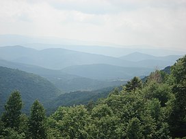
View from the slopes of Back Allegheny Mountain, looking east, in the Appalachian Mountains. Visible are Allegheny Mountain (in the Monongahela National Forest of West Virginia, middle distance) and Shenandoah Mountain (in the George Washington National Forest of Virginia, far distance).
Highest point
PeakMount Mitchell
Elevation6,684 ft (2,037 m)
Geography
Countries
  • United States
  • Canada
Regions
Geology
OrogenyTaconic
Rock ageOrdovician

Alps

[edit]
Side by side comparison
{{Infobox mountain}}{{Infobox mountain/sandbox}}
Alps
Highest point
PeakMont Blanc (Italian: Monte Bianco)
Elevation4,810.45 m (15,782.3 ft)
Coordinates45°50′01″N 06°51′54″E / 45.83361°N 6.86500°E / 45.83361; 6.86500
Geography
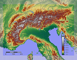
Relief of the Alps. See also map with international borders marked
Countries
  • Slovenia
  • France
  • Germany
  • Switzerland
  • Italy
  • Austria
  • Liechtenstein
Geology
OrogenyAlpine orogeny
Rock ageTertiary
Rock types
  • Bündner schist
  • flysch
  • molasse

Alps (map_image) + mapframe

[edit]
Side by side comparison
{{Infobox mountain}}{{Infobox mountain/sandbox}}
Alps
Highest point
PeakMont Blanc (Italian: Monte Bianco)
Elevation4,810.45 m (15,782.3 ft)
Coordinates45°50′01″N 06°51′54″E / 45.83361°N 6.86500°E / 45.83361; 6.86500
Geography
Relief of the Alps. See also map with international borders marked
Map
Countries
  • Slovenia
  • France
  • Germany
  • Switzerland
  • Italy
  • Austria
  • Liechtenstein
Geology
OrogenyAlpine orogeny
Rock ageTertiary
Rock types
  • Bündner schist
  • flysch
  • molasse

Andes

[edit]
Side by side comparison
{{Infobox mountain}}{{Infobox mountain/sandbox}}
Andes
Spanish: Cordillera de los Andes
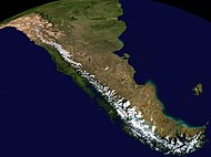
Aerial photo of a portion of the Andes between Argentina and Chile
Highest point
PeakAconcagua, Las Heras Department, Mendoza, Argentina
Elevation6,962 m (22,841 ft)
Coordinates32°39′10″S 70°0′40″W / 32.65278°S 70.01111°W / -32.65278; -70.01111
Dimensions
Length7,000 km (4,300 mi)
Width500 km (310 mi)
Naming
Native nameAnti (Quechua)
Geography
Composite satellite image of the southern Andes
Countries
  • Argentina
  • Bolivia
  • Chile
  • Colombia
  • Ecuador
  • Peru
  • Venezuela
Cities

Sierra Nevada

[edit]
Side by side comparison
{{Infobox mountain}}{{Infobox mountain/sandbox}}
Sierra Nevada
The Sierra's Mills Creek cirque (center) is on the west side of the Sierra Crest, south of Mono Lake (top, blue).
Highest point
PeakMount Whitney
Elevation14,505 ft (4,421 m)[36]
Coordinates36°34′43″N 118°17′31″W / 36.578580925°N 118.291994950°W / 36.578580925; -118.291994950
Dimensions
Length400 mi (640 km) north-south from Fredonyer Pass to Tehachapi Pass[33]
Width65 mi (105 km)[34]
Area24,370 sq mi (63,100 km2)[35]
Naming
Etymology1777: Spanish for "snowy mountain range"
Nickname(s)the Sierra, the High Sierra, the Sierras, Range of Light (1894, John Muir)[32]
Geography
Position of Sierra Nevada inside California
CountryUnited States
States
  • California
  • Nevada
Range coordinates37°44′N 119°34′W / 37.73°N 119.57°W / 37.73; -119.57
Geology
Rock ageMesozoic
Rock types
  • batholith
  • igneous

Catskill Mountains

[edit]
Side by side comparison
{{Infobox mountain}}{{Infobox mountain/sandbox}}
Catskill Mountains
Slide Mountain and the peaks around it as seen from Twin Mountain in the northern Catskills.
Highest point
PeakSlide Mountain, S of Shandaken
Elevation4,154 ft (1,266 m)
Coordinates41°59′55″N 74°23′11″W / 41.99861°N 74.38639°W / 41.99861; -74.38639
Dimensions
Length111 mi (179 km) N/S
Width102 mi (164 km) E/W
Area15,259 sq mi (39,520 km2)
Geography
Map of the main regions of the northeast Appalachians, with the Catskills as "C".
CountryUnited States
StateNew York
RegionHudson Valley
Counties
Communities
Parent rangeAppalachian
Borders on
Geology
Rock ages
Rock typeSedimentary

Unusual range cases

[edit]

map only, dim parameter

[edit]
Side by side comparison
{{Infobox mountain}}{{Infobox mountain/sandbox}}
Rocky Mountains
Rockies
Geography
Countries
  • Canada
  • United States
Region{hlist
Rocky Mountains
Rockies
Geography
Countries
  • Canada
  • United States
Region{hlist

|length_mi=3000 |range_coordinates=43°44′28″N 110°48′09″W / 43.741208°N 110.802414°W / 43.741208; -110.802414 |parent=North American Cordillera

|geology=

|period=

  • Precambrian
  • Cretaceous

|orogeny= |highest=Mount Elbert |highest_location=U.S.A. |elevation_ft=14440 |coordinates=39°07′03.90″N 106°26′43.29″W / 39.1177500°N 106.4453583°W / 39.1177500; -106.4453583}}

Range coordinates

[edit]
Side by side comparison
{{Infobox mountain}}{{Infobox mountain/sandbox}}
Buckskin Mountains (Arizona)
Buckskin Mountains (Arizona) is located in Arizona
Buckskin Mountains (Arizona)
in Arizona
Highest point
PeakBattleship Peak
Elevation2,569 ft (783 m)
Coordinates34°04′28″N 113°48′29″W / 34.074467°N 113.808027°W / 34.074467; -113.808027
Dimensions
Length30 mi (48 km) E-W & (SW x NE)
Geography
CountryUnited States
StateArizona
CountyLa Paz
Communities
Range coordinates34°10′12.123″N 113°50′46.345″W / 34.17003417°N 113.84620694°W / 34.17003417; -113.84620694
Borders onBill Williams & Rawhide Mountains-N
Bill Williams River-N
Butler ValleyHarcuvar Mountains-SE
Gibralter Mountain Wilderness-W
Buckskin Mountain State Park-W
Alamo Lake State Park-NE
Buckskin Mountains (Arizona)
Buckskin Mountains (Arizona) is located in Arizona
Buckskin Mountains (Arizona)
in Arizona
Highest point
PeakBattleship Peak
Elevation2,569 ft (783 m)
Coordinates34°04′28″N 113°48′29″W / 34.074467°N 113.808027°W / 34.074467; -113.808027
Dimensions
Length30 mi (48 km) E-W & (SW x NE)
Geography
CountryUnited States
StateArizona
CountyLa Paz
Communities
Range coordinates34°10′12.123″N 113°50′46.345″W / 34.17003417°N 113.84620694°W / 34.17003417; -113.84620694
Borders onBill Williams & Rawhide Mountains-N
Bill Williams River-N
Butler ValleyHarcuvar Mountains-SE
Gibralter Mountain Wilderness-W
Buckskin Mountain State Park-W
Alamo Lake State Park-NE

Range coordinates that are difficult to round

[edit]
Side by side comparison
{{Infobox mountain}}{{Infobox mountain/sandbox}}
Black Hills
Black Hills is located in California
Black Hills
Black Hills
location of Black Hills in California [6]
Highest point
Elevation1,158 m (3,799 ft)
Geography
CountryUnited States
StateCalifornia
DistrictSan Bernardino County
Range coordinates35°23′59.873″N 117°18′43.179″W / 35.39996472°N 117.31199417°W / 35.39996472; -117.31199417
Topo mapUSGS Black Hills
Black Hills
Black Hills is located in California
Black Hills
Black Hills
location of Black Hills in California [6]
Highest point
Elevation1,158 m (3,799 ft)
Geography
CountryUnited States
StateCalifornia
DistrictSan Bernardino County
Range coordinates35°23′59.873″N 117°18′43.179″W / 35.39996472°N 117.31199417°W / 35.39996472; -117.31199417
Topo mapUSGS Black Hills

Range coordinates specified only by degrees

[edit]
Side by side comparison
{{Infobox mountain}}{{Infobox mountain/sandbox}}
Imaginary range
Imaginary range is located in Nevada
Imaginary range
Imaginary range
Highest point
Coordinates37°25′56″N 117°32′10″W / 37.432348°N 117.5362443°W / 37.432348; -117.5362443
Geography
CountryUnited States
StateNevada
Range coordinates37°26′N 117°32′W / 37.43°N 117.54°W / 37.43; -117.54
Imaginary range
Imaginary range is located in Nevada
Imaginary range
Imaginary range
Highest point
Coordinates37°25′56″N 117°32′10″W / 37.432348°N 117.5362443°W / 37.432348; -117.5362443
Geography
CountryUnited States
StateNevada
Range coordinates37°26′N 117°32′W / 37.43°N 117.54°W / 37.43; -117.54

Country_type + native_name_lang

[edit]
Side by side comparison
{{Infobox mountain}}{{Infobox mountain/sandbox}}
Gagarin Mountains
Gagarin Mountains is located in Antarctica
Gagarin Mountains
Gagarin Mountains
Naming
Native nameKhrebet Yuriya Gagarina (Russian)
Geography
ContinentAntarctica
RegionQueen Maud Land, East Antarctica
Range coordinates71°57′S 09°23′E / 71.950°S 9.383°E / -71.950; 9.383
Parent rangeEast Antarctica Ranges
Gagarin Mountains
Gagarin Mountains is located in Antarctica
Gagarin Mountains
Gagarin Mountains
Naming
Native nameKhrebet Yuriya Gagarina (Russian)
Geography
ContinentAntarctica
RegionQueen Maud Land, East Antarctica
Range coordinates71°57′S 09°23′E / 71.950°S 9.383°E / -71.950; 9.383
Parent rangeEast Antarctica Ranges

Topo map

[edit]
Side by side comparison
{{Infobox mountain}}{{Infobox mountain/sandbox}}
Baldwin Hills
Baldwin Hills is located in California
Baldwin Hills
Baldwin Hills
Location of the Baldwin Hills in California [37]
Highest point
Elevation103 m (338 ft)
Geography
CountryUnited States
StateCalifornia
DistrictLos Angeles County
Range coordinates33°59′43″N 118°21′50″W / 33.99528°N 118.36389°W / 33.99528; -118.36389
Topo mapUSGS Inglewood
Baldwin Hills
Baldwin Hills is located in California
Baldwin Hills
Baldwin Hills
Location of the Baldwin Hills in California [37]
Highest point
Elevation103 m (338 ft)
Geography
CountryUnited States
StateCalifornia
DistrictLos Angeles County
Range coordinates33°59′43″N 118°21′50″W / 33.99528°N 118.36389°W / 33.99528; -118.36389
Topo mapUSGS Inglewood

Topo map + map_image + mapframe

[edit]
Side by side comparison
{{Infobox mountain}}{{Infobox mountain/sandbox}}
Baldwin Hills
Baldwin Hills is located in California
Baldwin Hills
Baldwin Hills
Location of the Baldwin Hills in California [37]
1927 Los Angeles Times map shows (1) the proposed extension of a 100-foot-wide La Brea Avenue between Jefferson Street through the Baldwin Hills toward Inglewood.
Map
Highest point
Elevation103 m (338 ft)
Geography
CountryUnited States
StateCalifornia
DistrictLos Angeles County
Range coordinates33°59′43″N 118°21′50″W / 33.99528°N 118.36389°W / 33.99528; -118.36389
Topo mapUSGS Inglewood
Baldwin Hills
Baldwin Hills is located in California
Baldwin Hills
Baldwin Hills
Location of the Baldwin Hills in California [37]
1927 Los Angeles Times map shows (1) the proposed extension of a 100-foot-wide La Brea Avenue between Jefferson Street through the Baldwin Hills toward Inglewood.
Map
Highest point
Elevation103 m (338 ft)
Geography
CountryUnited States
StateCalifornia
DistrictLos Angeles County
Range coordinates33°59′43″N 118°21′50″W / 33.99528°N 118.36389°W / 33.99528; -118.36389
Topo mapUSGS Inglewood

References

[edit]
  1. ^ test
  2. ^ a b c "Topographic map, NZTopo50-BJ34". Retrieved 30 December 2009.
  3. ^ test
  4. ^ a b c d placeholder
  5. ^ a b Hildreth placeholder
  6. ^ a b "Black Hills". Geographic Names Information System. United States Geological Survey, United States Department of the Interior. Retrieved 2009-05-04.
  7. ^ Wood placeholder
  8. ^ Hildreth03 placeholder
  9. ^ SI placeholder
  10. ^ Oakley2005 placeholder
  11. ^ Coleman1869 placeholder
  12. ^ a b c "Sunwapta Peak". Bivouac.com. Retrieved 2009-01-02.
  13. ^ "Sunwapta Peak". Peakbagger.com.
  14. ^ "Mount Fernow". Geographic Names Information System. United States Geological Survey, United States Department of the Interior.
  15. ^ Retrieved from the Swisstopo topographic maps
  16. ^ a b c d Wood, Charles A.; Kienle, Jürgen (1990). Volcanoes of North America: United States and Canada. Cambridge University Press. pp. 124, 125. ISBN 0-521-43811-X.
  17. ^ a b c "Mount Edziza". BC Geographical Names. Archived from the original on 2018-05-15. Retrieved 2021-09-25.
  18. ^ a b "Stikine volcanic belt: Mount Edziza". Catalogue of Canadian volcanoes. Natural Resources Canada. 2009-04-01. Archived from the original on 2009-06-08. Retrieved 2023-01-29.
  19. ^ Edwards & Russell 2000, p. 1283.
  20. ^ a b Yagi, Kenzo; Souther, Jack Gordon (1974). "Aenigmatite From Mt. Edziza, British Columbia, Canada" (PDF). American Mineralogist. 59. Mineralogical Society of America: 820. Archived from the original (PDF) on 2021-04-01. Retrieved 2021-09-27.
  21. ^ "Mount Edziza Provincial Park". BC Parks. Archived from the original on 2023-01-23. Retrieved 2024-01-30.
  22. ^ "A 502" (Topographic map). Telegraph Creek, Cassiar Land District, British Columbia (3 ed.). 1:250,000. 104 G (in English and French). Department of Energy, Mines and Resources. 1989. Archived from the original on 2021-05-02. Retrieved 2021-09-25.
  23. ^ Edwards, Benjamin Ralph (1997). Field, kinetic, and thermodynamic studies of magmatic assimilation in the Northern Cordilleran Volcanic Province, northwestern British Columbia (PhD thesis). University of British Columbia. pp. 6, 10, 11. ISBN 0-612-25005-9.
  24. ^ "Pillow Ridge". BC Geographical Names. Archived from the original on 2016-03-04. Retrieved 2021-09-26.
  25. ^ "Spectrum Range". BC Geographical Names. Archived from the original on 2020-06-30. Retrieved 2021-09-26.
  26. ^ Souther 1992, p. 1.
  27. ^ Souther, J. G.; Hickson, C. J. (1984). "Crystal fractionation of the basalt comendite series of the mount Edziza volcanic complex, British Columbia: Major and trace elements". Journal of Volcanology and Geothermal Research. 21 (1). Elsevier: 79. Bibcode:1984JVGR...21...79S. doi:10.1016/0377-0273(84)90017-9. ISSN 0377-0273.
  28. ^ Edwards & Russell 2000, p. 1284.
  29. ^ "Spectrum Range: General Information". Global Volcanism Program. Smithsonian Institution. Archived from the original on 2022-09-22. Retrieved 2022-10-03.
  30. ^ "International Appalachian Trail- Newfoundland". Iatnl.ca. Retrieved 2010-11-06.
  31. ^ Cees R. van Staal, Mineral Deposits of Canada: Regional Metallogeny: Pre-Carboniferous tectonic evolution and metallogeny of the Canadian Appalachians, Geological Survey of Canada website
  32. ^ Muir, John (1894). "The Sierra Nevada". The Mountains of California. New York: The Century Co. Retrieved 2010-05-29 – via Sierra Club.
  33. ^ "Sierra Nevada". Ecological Subregions of California. United States Forest Service.
  34. ^ "Sierra Nevada". SummitPost.org. Retrieved 2010-05-29.
  35. ^ "The Sierra Nevada Region". USCB Biogeography lab. Archived from the original on 2011-05-14.
  36. ^ "Mount Whitney". NGS Data Sheet. National Geodetic Survey, National Oceanic and Atmospheric Administration, United States Department of Commerce.
  37. ^ a b "Baldwin Hills". Geographic Names Information System. United States Geological Survey, United States Department of the Interior. Retrieved 2009-05-04.