Ticao Pass
Appearance
| Ticao Pass | |
|---|---|
 Sunset at Ticao Pass as seen from Bulan, Sorsogon | |
| Location | |
| Coordinates | 12°37′N 123°48′E / 12.617°N 123.800°E |
| Type | strait |
| Etymology | Ticao Island |
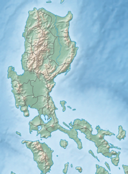
Ticao Pass is the strait that separates Ticao Island from the Bicol Peninsula in the Philippines.[1] It connects the Burias Pass in the north with the Samar Sea in the south.
Along with the Burias Pass, the waters of the Ticao Pass are proposed to become a Marine Protected Area. It is home to a large marine diversity, but it also suffers from massive overfishing and poaching, as well as destructive blast fishing.[2]
References
[edit]- ^ "Geographical Names: Ticao Pass: Philippines". Geographic.org. Retrieved 16 August 2016.
- ^ Danny O. Calleja (October 5, 2015). "Proposed declaration of Ticao-Burias Pass as protected seascape excites stakeholders". pnabicol.blogspot.ca. Legazpi City: Philippines News Agency. Retrieved 16 August 2016.


