User:Boa-tarde/opuwo
Opuwo | |
|---|---|
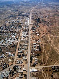
 aerial view of Opuwo | |
| Coordinates: 18°3′20″S 13°50′26″E / 18.05556°S 13.84056°E | |
| Country | |
| Region | Kunene Region |
| Constituency | Opuwo |
| Government | |
| • Mayor | Pieter de Villiers |
| Population (2001)[1] | |
• Total | 5,101 |
| Time zone | UTC+1 (South African Standard Time) |
Opuwo is the capital of the Kunene Region in north-western Namibia. The town is situated about 720 km north-northwest from the capital Windhoek, and has a population of 12 000.Opuwo is connected to Kamanjab and Windhoek with an excellent paved/tarred road.This exciting town is the gateway to the friendly and very interesting Himba People, the Epupa Waterfalls, the Marienfluss, Desert Elephants, Van Zyl's pass (where you need a good 4x4), Traditional villages of the Himba, Herero and Dhimba people, plus much more. Cllr Tuarungua Kavari (Swapo) is the town's mayor.[2]
History
[edit]The first office to be established in the area was the colonial administrator in Kaoko in 1997, which was located at the Swartbooi’s Drift on the banks of the Kunene River before the location's name was changed to Opuwo. This police station was run by Sergeant Herbert, and his aim was to receive the Angola Boers who had trekked to Angola out of refusal to accept the British government in South Africa. Sergeant Basson took over the office at Swartbooi‘s Drift, and excavated Opuwo's first bore hole. Basson had the nickname “Katjiriamakaja” (a person who eats tobacco).
Etymology
[edit]The name Opuwo was given by the commissioner of Ondangwa, Mr. Hugo Hahn, who came in search of land to build an office. Upon his arrival, he asked local headmen to give him land where he could build an office. The headmen gave him a small plot, and when the headmen tried to give him more land, Mr. Hahn responded saying "Opuwo (it’s enough for me). I don’t want any more land". That is how Opuwo got its name. The local residents of Opuwo called it Otjihinamaparero at the time, and some still call it that.[3]
The tradition and culture of inhabitants
[edit]Women are famous for covering themselves with a mixture of butter fat (sometimes Vaseline) and ochre, known as otjize, to protect them from the sun. The mixture gives them a reddish appearance said to symbolize the earth’s red soil and the blood that symbolizes life, both of which match the Himba’s idea of beauty. Women adorn themselves with bracelets, anklets, necklaces, iron belts and beautiful beads made from sea shells.Extended family members generally dwell in a homestead consisting of small, circular mud huts and work areas. The huts surround an ancestral fire, okuruwo, and a livestock enclosure. Together, the fire and livestock are closely linked to their ancestral beliefs and worship.Himba are infamous for wearing their traditional clothes made from animal hide. It is common for both men and women to go topless but men are quicker to wear a Western t-shirt with their traditional wear. If a woman is wearing a headdress-like crown made of animal hide on top of her head, it means she is married.[4]
Hugo Hahn called the land “Ohopoho Otjitopora” which means "they see the bore hole and their water comes out". The name Otjihinamaparero was changed to Opuwo in 1974 due to orthographic reform.
References
[edit]- ^ Republic of Namibia 2001 Population and Housing Census (Basic Analysis with Highlights ed.). Windhoek: Central Bureau of Statistics, National Planning Commission. July 2003. p. 21. ISBN 0-86976-614-7.
- ^ [[1]]
- ^ Hihanguapo. M.(2000).How Opuwo got its name. In G. Miescher & D. Henrichesen (Eds.), New notes on Kaoko (p. 9). Basel: Basler Afrika Bibliograghien.
- ^ [[2]]
External links
[edit]

