Alor Gajah
Appearance
Alor Gajah | |
|---|---|
Town and district capital | |
| Alor Gajah Town Bandar Alor Gajah | |
 | |
| Motto(s): Alor Gajah Dynamic - Progressive - Holistic (Malay: Alor Gajah Dinamik - Progresif - Holistik) | |
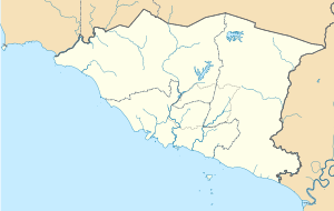
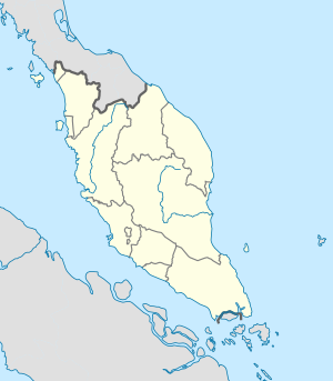
 Alor Gajah Town in Alor Gajah District (left) Alor Gajah District in Malacca State (right) | |
| Coordinates: 2°23′00″N 102°13′00″E / 2.38333°N 102.21667°E | |
| Country | |
| State | |
| District | Alor Gajah |
| Granted municipal status | 1 May 2003 |
| Government | |
| • Type | Local government |
| • Body | Alor Gajah Municipal Council |
| • President | Mohd Fadhil Hassan |
| • Alor Gajah Member of Parliament | Adly Zahari (AMANAH) |
| Population (2010) | |
• Alor Gajah Town | 21,267 |
| • Demonym | Alor Gajahan |
| Time zone | UTC+8 (MST) |
| • Summer (DST) | Not observed |
| Postal code | 78xxx |
| Area code(s) | +6065 (landline only) |
| Vehicle registration | M |
| Website | www |
Alor Gajah Municipal Council Majlis Perbandaran Alor Gajah | |
|---|---|
 | |
| Type | |
| Type | |
| History | |
| Founded | 1 May 2003 |
| Leadership | |
President | Saifuddin Abdul Karim |
Municipal Secretary | Saleh Mohd Dom |
| Meeting place | |
| Majlis Perbandaran Alor Gajah (MPAG), Lebuh AMJ, 78000 Alor Gajah, Melaka, Malaysia. | |
| Website | |
| www | |
Alor Gajah is a town and district seat of Alor Gajah District in the Malaysian state of Malacca. It is governed by Alor Gajah Municipal Council (Malay: Majlis Perbandaran Alor Gajah), which was formerly known as Alor Gajah District Council (Malay: Majlis Daerah Alor Gajah) from 1 July 1978 until 1 May 2003.[1]
Etymology
[edit]Alor Gajah used to be one of the forest areas believed to be the routes (Malay: alor) for wild elephants (Malay: gajah).[2]
Climate
[edit]| Climate data for Alor Gajah | |||||||||||||
|---|---|---|---|---|---|---|---|---|---|---|---|---|---|
| Month | Jan | Feb | Mar | Apr | May | Jun | Jul | Aug | Sep | Oct | Nov | Dec | Year |
| Mean daily maximum °C (°F) | 31 (88) |
32 (90) |
32 (90) |
32 (90) |
31 (88) |
31 (88) |
31 (88) |
30 (86) |
31 (88) |
31 (88) |
31 (88) |
30 (86) |
32.8 (91.0) |
| Mean daily minimum °C (°F) | 22 (72) |
22 (72) |
23 (73) |
23 (73) |
23 (73) |
23 (73) |
22 (72) |
22 (72) |
22 (72) |
22 (72) |
22 (72) |
22 (72) |
23.8 (74.8) |
| Average rainfall mm (inches) | 189.8 (7.47) |
210.1 (8.27) |
273.5 (10.77) |
298.9 (11.77) |
243.1 (9.57) |
128.7 (5.07) |
141.1 (5.56) |
168.9 (6.65) |
198.1 (7.80) |
280.1 (11.03) |
330.3 (13.00) |
261.2 (10.28) |
2,723.8 (107.24) |
| Average rainy days (≥ 1.0 mm) | 11 | 12 | 16 | 16 | 14 | 9 | 10 | 11 | 13 | 17 | 18 | 15 | 162 |
| Source: Climate Data[3] | |||||||||||||
Economy
[edit]Alor Gajah is home to Honda Malaysia's car manufacturing plant,[4] which assembling cars for the local market and also selected automotive parts for Honda's overall ASEAN market and also local biscuit producer - Julie's manufacturing plant.
Education
[edit]- Yayasan Alor Gajah College of Technology (KT-YAGA; Malay: Kolej Teknologi Yayasan Alor Gajah) Alor Gajah
Tourist attractions
[edit]- Alor Gajah British Graveyard[5]
- Alor Gajah Square - A town square which features a large bronze sculpture of a kris (dagger).[6][7]
- Freeport A'Famosa Outlet Village
Health
[edit]- Alor Gajah Hospital[8]
Transportation
[edit]- AG Sentral Bus Terminal
- Masjid Tanah Sentral
- Terminal Bas dan Teksi Pulau Sebang
- Pulau Sebang/Tampin railway station
Gallery
[edit]-
Alor Gajah Square
-
AG Sentral Bus Terminal
-
Former Alor Gajah Municipal Council Headquarters
See also
[edit]References
[edit]- ^ "Latar Belakang". 14 September 2021.
- ^ "Sejarah". 17 November 2020.
- ^ "Climate Data Org — Alor Gajah". Climate Data Org. Retrieved 16 December 2016.
- ^ "Honda". Archived from the original on 12 September 2018. Retrieved 12 September 2018.
- ^ "British Graveyard | AmazingMelaka.com". Archived from the original on 19 June 2015. Retrieved 8 June 2015.
- ^ "Keris Landmark". goMelaka. 3 July 2013.
- ^ "Dataran Keris gempar dengan 'kemalangan'". Archived from the original on 5 March 2016. Retrieved 11 August 2015.
- ^ "Alor Gajah Hospital website".
External links
[edit]Wikivoyage has a travel guide for Alor Gajah.


