Caxias do Sul Airport
Hugo Cantergiani Regional Airport Aeroporto Regional Hugo Cantergiani | |||||||||||
|---|---|---|---|---|---|---|---|---|---|---|---|
| Summary | |||||||||||
| Airport type | Public | ||||||||||
| Operator |
| ||||||||||
| Serves | Caxias do Sul | ||||||||||
| Time zone | BRT (UTC−03:00) | ||||||||||
| Elevation AMSL | 754 m / 2,474 ft | ||||||||||
| Coordinates | 29°11′53″S 051°11′12″W / 29.19806°S 51.18667°W | ||||||||||
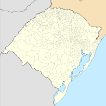
| Map | |||||||||||
 | |||||||||||
| Runways | |||||||||||
| |||||||||||
Hugo Cantergiani Regional Airport (IATA: CXJ, ICAO: SBCX), formerly called Campo dos Bugres Airport, is the airport serving Caxias do Sul, Brazil.
It is operated by the Municipality of Caxias do Sul.
History
[edit]This section needs additional citations for verification. (May 2023) |
Commissioned in March 1941, Caxias do Sul Airport has followed the evolution of aeronautics in the last eight decades. In addition to the runway, previously located in the current "Cinquentenário" neighborhood, the Caxias do Sul Aeroclube appeared in February of that year, with the objective of training pilots. The ceremony was attended by journalist Assis Chateaubriand, who launched the National Aviation Campaign, a project that provided tools for aviation schools.
According to researcher Roberto Grazziotin, the airport moved to "Salgado Filho" neighborhood in 1954.[citation needed]
In 1972, with the intention of welcoming President Médici, a 1,500-meter runway was paved. However, the strong momentum was triggered in 1987, when the airport improved and the State began the work of installing instruments and expanding the landing / takeoff runway from 1500 m to 2000 m, as well as the passenger terminal for the installation of the line. between Caxias / São Paulo.
Passengers used the 30-seat Brasilia plane from Rio-Sul, comparing flights scheduled between Monday and Friday.
The arrival of the Boeing 737-500 from Rio-Sul signaled the demand and a growing airport evolution in the municipality. In December 1993, tests were started with a modern aircraft to make the Caxias / Congonhas (SP) connection, with a stopover in Porto Alegre.
Gol Linhas Aéreas, which arrived at the Brazilian market with innovations and competitive prices, installed its services at the airport on October 27, 2004. At that time, the first flight with a Boeing 737-700 registered the arrival of 57 passengers and boarded 82 bound for São Paulo.
On November 10, 2011, Azul started offering services with daily lines to Curitiba and Campinas.
Previously operated by DAP with participation of the Municipality of Caxias do Sul, on August 26, 2022 the concession of the facility was transferred entirely to the Municipality.[3]
Airlines and destinations
[edit]Access
[edit]The airport is located 8 km (5 mi) from downtown Caxias do Sul.
See also
[edit]References
[edit]- ^ "Aeródromos". ANAC (in Portuguese). 22 August 2019. Retrieved 22 August 2020.
- ^ "Hugo Cantergiani (SBCX)". DECEA (in Portuguese). Retrieved 24 September 2023.
- ^ "Rio Grande do Sul passa outorga do aeroporto de Caxias do Sul para o município". Aeroin (in Portuguese). 26 August 2022. Retrieved 27 August 2022.
External links
[edit]- Airport information for SBCX at Great Circle Mapper. Source: DAFIF (effective October 2006).
- Current weather for SBCX at NOAA/NWS
- Accident history for CXJ at Aviation Safety Network


