Greenwell State Park
Appearance
| Greenwell State Park | |
|---|---|
 Tobacco barn in the park | |
| Location | St. Mary's County, Maryland, United States |
| Nearest town | California, Maryland |
| Coordinates | 38°22′08″N 76°31′45″W / 38.36889°N 76.52917°W |
| Area | 596 acres (241 ha)[1] |
| Elevation | 30 ft (9.1 m) |
| Established | 1971 |
| Administered by | Maryland Department of Natural Resources |
| Designation | Maryland state park |
| Named for | John and Mary Greenwell |
| Website | Official website |
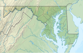
Greenwell State Park is a public recreation area located on the Patuxent River in St. Mary's County, Maryland.[2] The state park features the historic Rosedale Manor House[3] as well as the Bonds-Simms tobacco barns complex. Park activities include hiking, cycling, horseback riding, fishing, picnicking, hunting, swimming, and canoeing.[2]
History
[edit]The park originated in 1971, when John Phillip Greenwell, Jr. and his sister, Mary Wallace Greenwell, donated their 167-acre (68 ha) farm to the state for use as a public park. The state subsequently purchased the adjacent 430-acre (170 ha) Bond property and added it to the park.[2]
References
[edit]- ^ "DNR Lands Acreage Report" (PDF). Maryland Department of Natural Resources. Retrieved October 14, 2024.
- ^ a b c "Greenwell State Park". Maryland Department of Natural Resources. Retrieved October 19, 2016.
- ^ "The Rosedale Manor House". Maryland Department of Natural Resources. Retrieved October 14, 2024.
External links
[edit]Wikimedia Commons has media related to Greenwell State Park.
- Greenwell State Park Maryland Department of Natural Resources
- Greenwell State Park Map Maryland Department of Natural Resources

