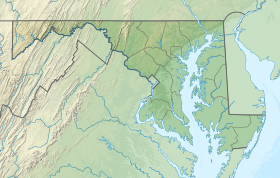
Heater's Island Wildlife Management Area
Appearance
| Heater's Island Wildlife Management Area | |
|---|---|
| Location | Frederick, Maryland, United States |
| Coordinates | 39°15′56″N 77°31′52.5″W / 39.26556°N 77.531250°W |
| Established | 1972 |
| Operator | Maryland Department of Natural Resources |
| Website | Heater's Island WMA |
Heater's Island Wildlife Management Area is a Wildlife Management Area in Frederick County, Maryland. Heater's Island is a large forested island in the Potomac River near Point of Rocks, Maryland. It was long inhabited by the Piscataway people, who were forced to leave by smallpox in 1705.[1]
See also
[edit]References
[edit]- ^ "Heater's Island WMA". Maryland Department of Natural Resources. Retrieved May 2, 2018.
External links
[edit]

