Khorramshahr County
Appearance
Khorramshahr County
Persian: شهرستان خرمشهر | |
|---|---|
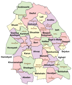
 Location of Khorramshahr County in Khuzestan province (bottom left, pink) | |
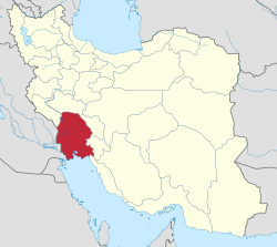
 Location of Khuzestan province in Iran | |
| Coordinates: 30°39′N 48°15′E / 30.650°N 48.250°E[1] | |
| Country | Iran |
| Province | Khuzestan |
| Capital | Khorramshahr |
| Districts | Central, Minu |
| Population (2016)[2] | |
• Total | 170,976 |
| Time zone | UTC+3:30 (IRST) |
| Khorramshahr County can be found at GEOnet Names Server, at this link, by opening the Advanced Search box, entering "9206387" in the "Unique Feature Id" form, and clicking on "Search Database". | |
Khorramshahr County (Persian: شهرستان خرمشهر)[a] is in Khuzestan province, Iran. Its capital is the city of Khorramshahr.[4]
History
[edit]After the 2016 National Census, Kut-e Sheykh neighborhood of the city of Khorramshahr was elevated to city status as Moqavemat.[5]
Demographics
[edit]Population
[edit]At the time of the 2006 census, the county's population was 155,224 in 32,563 households.[6] The following census in 2011 counted 163,701 people in 42,171 households.[7] The 2016 census measured the population of the county as 170,976 in 47,380 households.[2]
Administrative divisions
[edit]Khorramshahr County's population history and administrative structure over three consecutive censuses are shown in the following table.
| Administrative Divisions | 2006[6] | 2011[7] | 2016[2] |
|---|---|---|---|
| Central District | 147,642 | 155,434 | 161,820 |
| Gharb-e Karun RD | 4,821 | 4,663 | 5,774 |
| Howmeh-ye Gharbi RD | 10,567 | 11,632 | 12,682 |
| Howmeh-ye Sharqi RD | 8,388 | 9,721 | 10,267 |
| Khorramshahr (city) | 123,866 | 129,418 | 133,097 |
| Moqavemat (city)[b] | |||
| Minu District | 7,582 | 8,267 | 9,154 |
| Jazireh-ye Minu RD | 6,372 | 6,978 | 6,923 |
| Minushahr (city)[c] | 1,210 | 1,289 | 2,231 |
| Total | 155,224 | 163,701 | 170,976 |
| RD = Rural District | |||
See also
[edit]![]() Media related to Khorramshahr County at Wikimedia Commons
Media related to Khorramshahr County at Wikimedia Commons
Notes
[edit]References
[edit]- ^ OpenStreetMap contributors (21 December 2024). "Khorramshahr County" (Map). OpenStreetMap (in Persian). Retrieved 21 December 2024.
- ^ a b c Census of the Islamic Republic of Iran, 1395 (2016): Khuzestan Province. amar.org.ir (Report) (in Persian). The Statistical Center of Iran. Archived from the original (Excel) on 21 October 2020. Retrieved 19 December 2022.
- ^ "مدينة المحمرة" [Al-Muhammarrah City]. al-ahwaz.com. Archived from the original on 6 December 2024. Retrieved 6 December 2024.
تقع عند مصب نهر كارون في شط العرب ، شيدها يوسف بن مرداو ثاني امراء امارة المحمرة وذلك سنة 1229 هجـ - 1812 م وهو من شيوخ قبيلة البوكاسب الكعبية العربية ، ابدل الاحتلال الفارسي اسمها العربي بأسم فارسي فسميت ( خرمشهر ) . وتبعـد عن مد ينة الأحواز ( 120 كم ) ، وهى ميناء تجاري مهم .
[It is located at the mouth of the Karun River on the Shatt al-Arab. It was built in 1229 AH / 1812 CE by Yusuf bin Mirdaw, the second ruler of the Emirate of Mohammerah, who was one of the sheikhs of the Arab Bukasib tribe of the Ka'b. The Persian occupation changed its Arabic name to a Persian one, calling it "Khorramshahr." It is 120 kilometers away from the city of Ahwaz and serves as an important commercial port.] - ^ Habibi, Hassan (26 July 2014) [Approved 21 June 1369]. Approval of the organization and chain of citizenship of the elements and units of the national divisions of Khuzestan province, centered in the city of Ahvaz. rc.majlis.ir (Report) (in Persian). Ministry of the Interior, Political and Defense Commission of the Government Board. Proposal 3233.1.5.53; Letter 907-93808; Notification 82830/T126K. Archived from the original on 17 July 2014. Retrieved 25 January 2024 – via Islamic Parliament Research Center.
- ^ a b Habibi, Hassan (c. 2023) [Approved 29 April 2016]. Approval letter regarding the transformation of Kut-e Sheykh neighborhood into the city of Moqavemat. qavanin.ir (Report) (in Persian). Ministry of the Interior, Political-Defense Commission of the Government Council. Proposal 5153/42/4/1; Resolution 93808/T907. Archived from the original on 4 August 2023. Retrieved 4 August 2023 – via Laws and Regulations Portal of the Islamic Republic of Iran.
- ^ a b Census of the Islamic Republic of Iran, 1385 (2006): Khuzestan Province. amar.org.ir (Report) (in Persian). The Statistical Center of Iran. Archived from the original (Excel) on 20 September 2011. Retrieved 25 September 2022.
- ^ a b Census of the Islamic Republic of Iran, 1390 (2011): Khuzestan Province. irandataportal.syr.edu (Report) (in Persian). The Statistical Center of Iran. Archived from the original (Excel) on 18 January 2023. Retrieved 19 December 2022 – via Iran Data Portal, Syracuse University.
- ^ Habibi, Hassan (c. 2024) [Approved 12 May 1375]. Change of Chumeh village from Khorramshahr County in Khuzestan province to Minushahr. lamtakam.com (Report) (in Persian). Ministry of the Interior, Political-Defense Commission of the Government Board. Proposal 1.4.42.10275; Letter 93808-907; Notification 123771/17553K. Archived from the original on 26 January 2024. Retrieved 26 January 2024 – via Lam ta Kam.

