Sisaket province
Sisaket
ศรีสะเกษ (Thai) ซีซะเกด (Northern Khmer) | |
|---|---|
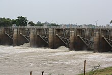
From top: Khao Phra Wihan National Park, Mun River in Rasi Salai District, Si Saket Tower, Prasat Huai Thap Than, Sri Nakhon Lamduan Stadium, Prang Ku | |
| Nickname(s): Si Nakorn Lamduan (honour of lamduan city) | |
| Motto(s): หลวงพ่อโตคู่บ้าน ถิ่นฐานปราสาทขอม ข้าว หอม กระเทียมดี มีสวนสมเด็จ เขตดงลำดวน หลากล้วนวัฒนธรรม เลิศล้ำสามัคคี ("Home of Luang Pho To. Lands of the Khmer castles. Good rice, shallots, garlic. Suan Somdet. The areas of the Lamduan flower. Plenty of culture. Amazing unity.") | |
 Map of Thailand highlighting Sisaket province | |
| Country | Thailand |
| Capital | Sisaket |
| Government | |
| • Governor | Anuphong Suksomnit (since 2023) |
| Area | |
• Total | 8,936 km2 (3,450 sq mi) |
| • Rank | Ranked 21st |
| Population (2019)[2] | |
• Total | 1,472,859 |
| • Rank | Ranked 10th |
| • Density | 165/km2 (430/sq mi) |
| • Rank | Ranked 22nd |
| Human Achievement Index | |
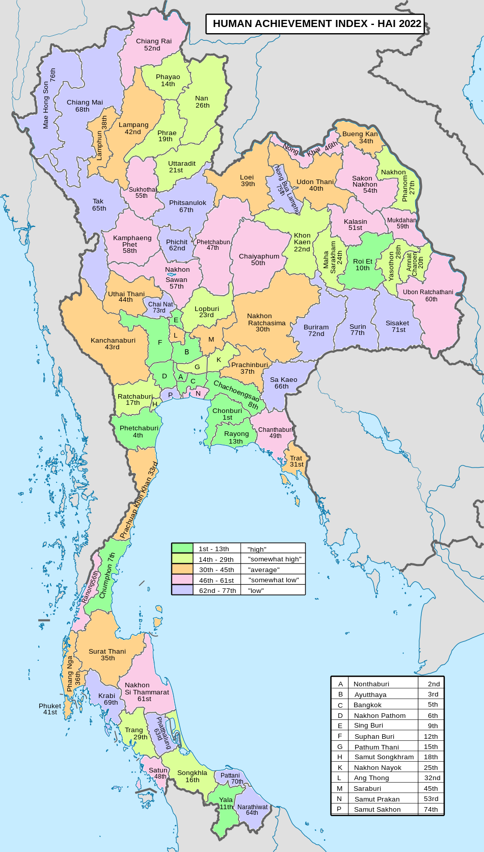
| • HAI (2022) | 0.6137 "low" Ranked 71st |
| GDP | |
| • Total | baht 70 billion (US$2.3 billion) (2019) |
| Time zone | UTC+7 (ICT) |
| Postal code | 33xxx |
| Calling code | 045 |
| ISO 3166 code | TH-33 |
| Website | www |
Sisaket province (Thai: ศรีสะเกษ, RTGS: Si Sa Ket,[5] pronounced [sǐː sàʔ kèːt]; Northern Khmer: ซีซะเกด) is one of Thailand's seventy-six provinces (changwat). It lies in lower northeastern Thailand, a region called Isan. Neighboring provinces are (from west clockwise): Surin, Roi Et, Yasothon, and Ubon Ratchathani. To the south it borders Oddar Meancheay and Preah Vihear of Cambodia.
Geography
[edit]The province is in the valley of the Mun River, a tributary of the Mekong. The Dângrêk mountain chain, which forms the border with Cambodia, is in the south of the province. The total forest area is 1,025 km2 (396 sq mi) or 11.5 percent of provincial area.[1] Khao Phra Wihan National Park covers an area of 130 km2 of the Dângrêk mountains in the southeast of the province. Established on 20 March 1998, it is named after a ruined Khmer Empire temple Prasat Preah Vihear (anglicised in Thailand as Prasat Khao Phra Wihan), now in Cambodia, which had been the focus of boundary dispute. The temple faces north and was built to serve the Sisaket region. Earlier maps had shown it as inside Thailand. However, a boundary survey conducted by the French for the Franco-Siamese Treaty of 1907 deviated from the agreed-upon international divide by watershed in order to place the temple on the French (Cambodian) side.
The Thai government ignored the deviation and continued to regard the temple as being in Sisaket province. In the mid-1950s, newly independent Cambodia protested the Thai "occupation" of what the French map showed as theirs. Since the French map was clearly incorrect, in 1962 the Thai government agreed to submit the dispute to the International Court of Justice. The court voted nine to four to confirm the border as shown in 1907 map and awarded the temple to Cambodia. Access to the temple is still principally from the Thai side, as the ruins are difficult to reach from the Cambodian plains at the bottom of a sheer cliff several hundred meters below. The Cambodian government has expressed interest in building a cable car to carry tourists to the site, though this has yet to happen, pending resolution of the ownership of other areas in the Cambodian–Thai border dispute.[citation needed]
National park
[edit]There is one national park, along with five other national parks, make up region 9 (Ubon Ratchathani) of Thailand's protected areas.
- Khao Phra Wihan National Park, 130 km2 (50 sq mi)[6]: 83
Wildlife sanctuaries
[edit]There are two wildlife sanctuaries, along with four other wildlife sanctuaries, make up region 9 (Ubon Ratchathani) of Thailand's protected areas.
- Huai Sala Wildlife Sanctuary, 380 km2 (150 sq mi)[7]: 8
- Phanom Dong Rak Wildlife Sanctuary, 316 km2 (122 sq mi)[7]: 7
History
[edit]The many Khmer ruins found in the province show the area must have been important to the Khmer empire at least by the 12th century, although it was apparently sparsely populated. According to local tradition, it was known as Sri Nakorn Lamduan (ศรีนครลำดวน.) It was later called Khukhan, after a town built in the late-15th century CE during the reign of King Boromaratcha III of Ayutthaya. Ethnic Laos began settling the northern portion of the province, and in 1786 the town Sisaket was formed, subject to Khukhan. In 1904, Sisaket was renamed Khukhan, while the original Khukhan was designated Huai Nua.

Monthon Udon Thani was created in 1912, and assumed the administration of the most of region. In 1933 the monthon system was ended, and the province of Khukhan was administered directly from Bangkok. Five years later, the name of the town and province were restored to Sisaket, with the district containing Huai Nua being called Khukhan.
The Rasi Salai Dam built here in 1994 was unofficially decommissioned in July 2000, following devastation of local farming villages.[citation needed]
Demographics
[edit]The province is populated by four main ethnic groups: Kui, Lao, Khmer, and Yer.[8] Sisaket is one of the provinces where there is a sizable northern Khmer population. In the 2000 census it was reported that 26.2 percent of the population are capable of speaking Khmer. This is down from the 1990 census when it was reported that 30.2 percent of the population were capable of speaking Khmer.[9] The majority are Lao speaking people.
Symbols
[edit]The provincial seal shows Prasat Hin Ban Samo, a Khmer temple about 1,000 years old, in the Prang Ku District.
The provincial tree and flower of the province is the lamduan. The six leaves of the flower symbolise the six original districts of the province: Khukhan, Kantharalak, Uthumphon Phisai, Kanthararom, Rasi Salai, and Khun Han. The provincial aquatic life is the Chinese edible frog (Hoplobatrachus rugulosus).
Economy
[edit]Sisaket is largely agricultural.[citation needed] Among other agricultural produce, it is known for its garlic and its shallots, for which it was rewarded with GI registration in 2020.[10]
Administrative divisions
[edit]
Provincial government
[edit]The province is divided into 22 districts (amphoes). The districts are further subdivided into 206 sub-districts (tambons) and 2,411 villages (mubans).
Local government
[edit]As of 26 November 2019 there is one Sisaket Provincial Administration Organisation (ongkan borihan suan changwat) and 37 municipal (thesaban) areas in the province.[11] Sisaket and Kantharalak have town (thesaban mueang) status. There are a further 35 subdistrict municipalities (thesaban tambon). The non-municipal areas are administered by 179 Subdistrict Administrative Organisations, SAO (ongkan borihan suan tambon).[2]
Transportation
[edit]Sisaket is on the northeastern railway line from Bangkok (กรุงเทพอภิวัฒน์) to Warin Chamrap (วารินชำราบ). Sisaket's main station is Sisaket Railway Station. Sisaket has frequent bus service to and from Bangkok's Northern Bus Terminal (Thai: หมอชิดใหม่; RTGS: mo chit mai)
Health
[edit]Sisaket's main hospital is Sisaket Hospital, a regional hospital operated by the Ministry of Public Health.
Human achievement index 2022
[edit]| Health | Education | Employment | Income |
| 52 | 73 | 64 | 64 |
| Housing | Family | Transport | Participation |

|
 |

|
|
| 15 | 35 | 42 | 42 |
| Province Sisaket, with an HAI 2022 value of 0.6137 is "low", occupies place 71 in the ranking. | |||
Since 2003, United Nations Development Programme (UNDP) in Thailand has tracked progress on human development at sub-national level using the Human achievement index (HAI), a composite index covering all the eight key areas of human development. National Economic and Social Development Board (NESDB) has taken over this task since 2017.[3]
| Rank | Classification |
| 1 - 13 | "high" |
| 14 - 29 | "somewhat high" |
| 30 - 45 | "average" |
| 46 - 61 | "somewhat low" |
| 62 - 77 | "low" |
| Map with provinces and HAI 2022 rankings |

|
See also
[edit]References
[edit]- ^ a b "ตารางที่ 2 พี้นที่ป่าไม้ แยกรายจังหวัด พ.ศ.2562" [Table 2 Forest area Separate province year 2019]. Royal Forest Department (in Thai). 2019. Retrieved 6 April 2021, information, Forest statistics Year 2019, Thailand boundary from Department of Provincial Administration in 2013
{{cite web}}: CS1 maint: postscript (link) - ^ a b รายงานสถิติจำนวนประชากรและบ้านประจำปี พ.ส.2562 [Statistics, population and house statistics for the year 2019]. Registration Office Department of the Interior, Ministry of the Interior. stat.bora.dopa.go.th (in Thai). 31 December 2019. Retrieved 26 February 2020.
- ^ a b "ข้อมูลสถิติดัชนีความก้าวหน้าของคน ปี 2565 (PDF)" [Human Achievement Index Databook year 2022 (PDF)]. Office of the National Economic and Social Development Council (NESDC) (in Thai). Retrieved 12 March 2024, page 69
{{cite web}}: CS1 maint: postscript (link) - ^ "Gross Regional and Provincial Product, 2019 Edition". <>. Office of the National Economic and Social Development Council (NESDC). July 2019. ISSN 1686-0799. Retrieved 22 January 2020.
- ^ ราชบัณฑิตยสถาน (2000-09-14). "ประกาศราชบัณฑิตยสถาน เรื่อง การเขียนชื่อจังหวัด เขต อำเภอ และกิ่งอำเภอ ลงวันที่ ๖ กรกฎาคม ๒๕๔๓" (PDF). ราชกิจจานุเบกษา (in Thai). ๑๑๗ (พิเศษ ๙๔ ง). กรุงเทพฯ: สำนักเลขาธิการคณะรัฐมนตรี: ๔๓. Archived from the original (PDF) on January 25, 2012.
- ^ "ข้อมูลพื้นที่อุทยานแห่งชาติ ที่ประกาศในราชกิจจานุบกษา 133 แห่ง" [National Park Area Information published in the 133 Government Gazettes]. Department of National Parks, Wildlife and Plant Conservation (in Thai). December 2020. Retrieved 1 November 2022.
- ^ a b "ตาราง 5 พื้นที่เขตรักษาพันธุ์สัตว์ป่า พ.ศ. 2562" [Table 5 Wildlife Sanctuary Areas in 2019] (PDF). Department of National Parks, Wildlife Sanctuaries and Plant Conservation (in Thai). 2019. Retrieved 1 November 2022.
- ^ Saengmanee, Pattarawadee (2019-03-23). "Splendid in Si Sa Ket". The Nation. Retrieved 2019-03-23.
- ^ "(Si Sa Ket) Key indicators of the population and household, population and housing census 1990 and 2000." Population and Housing Census 2000.(retrieved 14 Jul 2009)
- ^ Arunmas, Phusadee (24 June 2020). "Sri Sa Ket shallots, garlic join GI registration list". Bangkok Post. Retrieved 24 June 2020.
- ^ "Number of local government organizations by province". dla.go.th. Department of Local Administration (DLA). 26 November 2019. Retrieved 10 December 2019.
External links
[edit] Sisaket travel guide from Wikivoyage
- Province page from the Tourist Authority of Thailand
- Website of province (limited English section)
- Si Saket provincial map, coat of arms and postal stamp


