
User:Quake1234/sandbox2
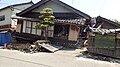
.jpg)  _helicopter_of_Barpak_area_in_Nepal_turned_into_a_wreckage_following_a_recent_massive_earthquake.jpg)  
| |
| UTC time | 2023-02-05 18:17:35 |
|---|---|
| Local date | 6 February 2023 |
| Local time | 04:17:35 (PST) 03:17:35 (EIT) |
| Duration | 10-12 minutes |
| Magnitude | 9.4 Mw |
| Depth | 32.0 km (20 mi) |
| Epicenter | 5°22′23″S 146°29′17″E / 5.373°S 146.488°E |
| Fault | Madang Fault, Momase Megathrust, Karkar Fault |
| Type | Megathrust, Strike-slip, Reverse |
| Areas affected | Papua, Indonesia (earthquake) Pacific Rim (tsunami) |
| Total damage | US$646.9 billion |
| Max. intensity | MMI XII (Extreme) |
| Peak acceleration | 4.55 g |
| Tsunami | 52.6 m (173 ft) |
| Landslides | Yes |
| Aftershocks | 283 Mw 6.0+ (as of January 2024) Strongest is Mw 8.7 (Ms 9.0) |
| Casualties | 534,039 dead, 3,239,181 injured, 48,769 missing |


On 6 February 2023, at 04:17:35 local time (UTC+10), a major earthquake with a magnitude of 9.4 struck the island of New Guinea, with an epicenter offshore Madang Province of Papua Prefecture, Papua. The earthquake was located 30 km (19 mi) north of Saidor.[1] It was followed by numerous aftershocks, including a Mw 8.7 event on May 10, which was centred 37 km (23 mi) south of Kandrian in New Britain.[2] There was widespread damage and millions of casualties in both Papua and Indonesia.[3]
The Mw 9.4 earthquake is the most powerful seismic event in both Papua and Indonesia,[4] and the second most powerful earthquake recorded in the world since modern seismography began in 1900.[5] The earthquake triggered powerful tsunami waves that reached 52.6 m (173 ft) in Saidor and travelled up to 10 km (6 mi) inland.[6] Coastal areas in the Momase Region had only five to ten minutes of warning, and many evacuation sites were washed away.[7]
The earthquake had a maximum Mercalli intensity of XI-XII (Extreme) in Saidor and Karkar Island, while the earthquake's long rupture also reached Papua Province in Indonesia, where an intensity of IX-X (Violent-Extreme) was recorded in Jayapura.[8] There were more than 530,000 aftershocks in the three months that followed.[9] The seismic sequence consisted of multiple strike-slip and megathrust ruptures on several faults. Due to this rupturing, it has been considered the most complex earthquake in centuries.
The earthquake is often referred to in Papua as the Great New Guinea Earthquake or simply 2/6, and is also known as the 2023 Madang earthquake, the Great Madang Earthquake,[10] the Great Momase earthquake, and the Great Earthquake of February 6.[11]
Damage from the earthquake occurred in an area of about 900,000 km2 (350,000 sq mi), about the size of Venezuela.[12] Over 220 million people in mainland Papua were affected, of which 64 million were left homeless, over 21% of the country's population of 303 million residents (as of 2022).[13] The confirmed death toll in Papua stood at over 428,000, including around 73,000 from the tsunami; initially, the death toll was estimated at over 540,000.[14] An additional 100,000 were killed in Indonesia, nearly all of them in the city of Jayapura, which was mostly destroyed, while 54 deaths occurred in other areas around the Pacific Rim from the tsunami.[15] It is the deadliest earthquake in Papua's modern history, and the deadliest in Indonesia since the 2004 Indian Ocean earthquake and tsunami.[16] It is also the deadliest worldwide since the 1920 Haiyuan earthquake, and the deadliest natural disaster of the 21st century.[17] Damages were estimated at US$646.9 billion in Papua (including $83 billion put into reconstruction efforts), and US$45.8 billion in Indonesia, surpassing the 2011 Tōhoku earthquake and tsunami as the costliest event of all time; about 25% of Papua's GDP had to be spent to cover the disasters' costs, resulting in a major economic crisis for the country which left 27% of Papua's residents living below the poverty line.[18] President James Marape has considered the earthquake and tsunami a national tragedy, calling the disaster "his country's 9/11".
Damaged roads, heavy rains, and disruption to communications greatly hampered the PGA's rescue and relief effort, which included a 180,000-strong search-and-rescue force,[19] 15,000 health workers[20] and 90,000 volunteers.[21] Following Papua and Indonesia's call for international help, more than 463,000 people from 180 countries joined the rescue effort.[22] Following the earthquakes, Marape made a deal with China's Xi Jinping, and US president Joe Biden, to start a major rebuilding project, which involved the reconstruction of potentially millions of structures damaged in the earthquake; the project costed Papua $83 billion.[23] As of March 2024, 65% of buildings destroyed or severely damaged were rebuilt, and 41.6 million residents displaced by the earthquake returned home.[24] Over 1,500 memorials were made to commemorate victims of the disaster, over 450 of them overseas.[25]
Tectonic setting[edit]

The earthquake occurred in a tectonically complex region where the Australian Plate moves east-north-east-wards relative to the Pacific Plate. It moves at a velocity of about 100 mm (4 in) a year. Earthquakes in this region are generally associated with the large-scale convergence of these two major plates and with the complex interactions of several associated microplates, most notably the South Bismarck Plate, the Solomon Sea microplate, and the Woodlark Plate.[26]
The earthquake struck deep beneath the Finisterre Range,[27] a large mountain range mainly consisting of volcaniclastics and volcanic strata that were uplifted 3.7 million years ago. The mountain range is prone to landslides caused by rain and earthquakes. In 1993, a series of highly destructive earthquakes struck the range.[28]
Papua is one of the most seismically active areas in the world. It is estimated that several hundred earthquakes of magnitude five or greater occur each year in the country. The seismic vulnerability of Papua was recognized in 1932 following the development of hazard maps. However, these maps often underestimated the true level of danger. The majority of buildings are constructed with masonry, and are not resistant to earthquakes, although newer structures are more resistant as they are built with steel or wood.[29]
February 6 event[edit]
The United States Geological Survey measured the initial earthquake at magnitude 8.9, before downgrading it to 8.8, and upgrading it to 9.0 several hours later, and then 9.4 a week after the event occurred. The Papuan Geophysical Agency reported a magnitude of 8.6, which was then downgraded to 8.4 about 30 minutes later.[30] Upon discovering that the event consisted of multiple conjoined fault ruptures, the earthquake's magnitude was revised to Ms 9.3.[31]
The mainshock had an epicenter 34 km (21 mi) north of Saidor. The shock had a focal mechanism corresponding to shallow megathrust, reverse and strike-slip faulting.[32] The rupture occurred on either a northwest–southeast striking, northeast dipping or northwest–southeast striking, northwest dipping fault.[33]
The event started with a Mw 8.2 earthquake at 04:17:35, that ruptured 285 km (177 mi) of the Madang Fault, from Saidor to Kandrian, for 109 seconds. A second event, measuring Mw 7.8, occurred at 04:19:52, 28 seconds after the first event ended, and ruptured the 143 km (89 mi) long Karkar Fault in its entirety, stretching from Saidor to northeastern Madang Province for 75 seconds. A 654 km (406 mi) long section of the Momase Megathrust, stretching from Jayapura in Indonesia to the northwestern section of the second rupture, triggered a Mw 9.3 event at 04:21:38, 31 seconds after the second rupture. The entire fault ruptured, which surprised geologists, as it was believed only sections of the fault could rupture at a time, triggering events up to Mw 8.5.[34] The reason why all ruptures happened within the span of 12 minutes, was that energy carried out my the first Mw 8.2 rupture was much higher than usual, to the point where it added extreme stress to the Karkar Fault, causing it to rupture with a similar amount of energy, which carried over to the eastern section of the Momase Megathrust and caused the entire fault to rupture.[35] Scientists discovered that the combined ruptures resulted in huge amounts of energy, 92,199 times more energy than the nuclear bomb used in Hiroshima, Japan in 1945.[36] Despite the event consisting of three separate earthquakes, the USGS, EMSC, PGA, JMA and other sources interpret this as a single event due to the energy transfer.[37]
Preliminary analysis of the effects of stress changes caused by the M9.4 earthquake on the New Britain Megathrust, based on the USGS fault model, indicated up to 3 bars of added stress near the epicenter of the M8.7 shock on May, sufficient to trigger rupture on that zone, assuming that it was already close to failure.[38] Stress on the Kairiru Fault, source of the 20 February M8.0 aftershock, increased by 2 bars following the 6 February earthquake.[39]
Intensity[edit]
| Intensity | Province | Location(s) | Population exposure (Papua) |
|---|---|---|---|
| XII | Madang | Karkar | 844k |
| XI | Madang | Saidor | 1,057k |
| X | Madang | Madang, Long Island | 22,783k |
| Morobe | Tawae-Siassi District, Umboi | ||
| East Sepik | Wewak, Marienberg | ||
| New Britain | Gloucester | ||
| Papua, Indonesia | Jayapura | ||
| IX | Morobe | Lae, Finschhafen | 143,687k |
| East Sepik | Angoram, Gawi | ||
| New Britain | Kandrian, Kimbe | ||
| Highlands | Mount Hagen, Kundiawa, Mendi, Wabag, Goroka, Kainantu | ||
| Sandaun | Aitape, Vanimo | ||
| VIII | Morobe | Bulolo | 61,785k |
| New Britain | Bialla, Hoskins, Pomio | ||
| Highlands | Tari, Ialibu | ||
| Gulf | Kerema | ||
| Oro | Popondetta | ||
| Manus | Lorengau | ||
| Milne Bay | Kiriwina | ||
| VII | New Britain | Kokopo | 54,464k |
| Gulf | Kikori | ||
| Oro | Kokoda | ||
| Milne Bay | Fergusson | ||
| Moresby | Port Moresby | ||
| Fly | Kiunga | ||
| New Ireland | Kavieng | ||
| VI | Milne Bay | Alotau | 25,003k |
| Fly | Daru | ||
| New Ireland | Namatanai | ||
| Bougainville | Arawa, Buka |
Tremors were felt across an area several thousand kilometres in size. The tremors were felt in northern Australia,[41] and as far as Ambon Island, Indonesia and Port Vila in Vanuatu Prefecture.[42]
Prior to discovering the events' complex and consecutive ruptures, scientists found that the shaking intensities in Madang, Umboi and Long Island, while still extremely strong and damaging, were much lower than expected.[43]
Geological effects[edit]
Liquefaction was identified via satellite and remote sensing on the full rupture from Jayapura to Kandrian. Liquefaction and lateral spreading were observed at and near coastal areas, fluvial valleys and drained lake or swamp areas, covered by Holocene sediments.[44] These effects were widespread in East Sepik Province and in Saidor. High levels of liquefaction was also observed in Lorengau, Popondetta, Port Moresby and Daru. Lateral spreading occurred in most areas affected by severe shaking, as far away as Tari, Kimbe and Mount Hagen. Many buildings within 100 km (62 mi) of the rupture were affected by liquefaction and lateral spreading, with Karkar Island, Madang, Wewak and Finschhafen being the most affected by this phenomena.
About 1,860 km (1,160 mi) of coastline spanning Jayapura in Indonesia, as well as the Papuan provinces of Sandaun, East Sepik, Madang, Morobe and New Britain, was raised and the shore moved seawards by up to 2 km (1.2 mi).[45] Saidor's port was uplifted 7 m (23 ft).[46]
The PGA said parts of Papua moved up to 4 m (13 ft) closer to North America with the maximum displacement observed at Saidor due to crustal deformation. At Madang, land shifted 3 m (9.8 ft) westwards. However, the agency said these movements could be slope or local ground movement instead.[47] The agency also added that crustal uplift of 11 m (36 ft) at Saidor and 5 m (16 ft) in Wewak.[48]
Across mountainous parts of Papua, landslides were widespread.[49] There was also extensive slope failures,[50] particularly in Highlands and Eastern Highlands Provinces.[51] The number of landslides was estimated at over 61,000, the most caused by an earthquake.[52]
May 10 event[edit]
On May 10 2023, a Mw 8.7 earthquake hit south of Kandrian, considered an aftershock, as the western part of the shock ruptured on two of the same faults as the mainshock.[53] The Papuan Geophysical Agency reported a magnitude of 9.0, which was then downgraded to 8.8 two days later.[54] Like the 6 February event, the shock had a focal mechanism corresponding to shallow megathrust faulting.[55] The rupture occurred on either a northeast–southwest striking, northwest dipping or northeast–southwest striking, northeast dipping fault.[56]
The event consisted of five ruptures measuring Mw 7.2, Mw 7.5, Mw 7.7, Mw 8.3 and Mw 8.4 respectively.[57]
| Intensity | Province | Location(s) | Population exposure |
|---|---|---|---|
| X | New Britain | Kandrian, Gasmata | 1,926k |
| IX | New Britain | Kimbe | 11,506k |
| Morobe | Umboi, Finschhafen | ||
| VIII | New Britain | Kokopo, Duke of York | 37,366k |
| Morobe | Lae | ||
| Madang | Saidor, Madang, Long Island | ||
| New Ireland | Konoagil | ||
| VII | Morobe | Bulolo | 53,213k |
| Madang | Karkar | ||
| New Ireland | Kandrian, Namatanai | ||
| Bougainville | Buka, Arawa | ||
| Highlands | Goroka, Kainantu | ||
| Oro | Popondetta | ||
| Milne Bay | Fergusson | ||
| VI | Highlands | Mount Hagen, Mendi | 132,237k |
| Milne Bay | Alotau | ||
| Moresby | Port Moresby | ||
| East Sepik | Angoram, Pagwi, Wewak | ||
| Gizo | Gizo | ||
| Chioseul | Chioseul |
Aftershocks[edit]
Over 570 aftershocks ≥Mw 5.0 were recorded within 24 hours of the Mw 8.8 earthquake, and within a year of the mainshock, there were 283 aftershocks above Mw 6.0, including 13 of between Mw 7.0-7.9 and three more above Mw 8.0.[59] Due to the earthquake's intense aftershocks, the year of 2023 had 407 earthquakes of between Mw 6.0-6.9, a number which usually happens within the span of four years.[60] The earthquake has been thought to have had the most damaging aftershock sequence.[61]
| Date (local) | Location | Mw | MMI (PGA) |
|---|---|---|---|
| 2023-02-06 04:26 | 29 km NE of Saidor | 7.3 Mw 7.1 Ms |
VIII |
| 2023-02-06 04:28 | 25 km NW of Saidor | 8.0 Mw 8.1 Ms |
X |
| 2023-02-06 04:36 | 25 km NE of Madang | 7.2 Mw 7.4 Ms |
IX |
| 2023-02-06 04:48 | 75 km SSW of Kandrian | 6.5 Mw 6.9 Ms |
VII |
| 2023-02-06 04:58 | 9 km SW of Karkar | 6.7 Mw 6.9 Ms |
IX |
| 2023-02-06 05:03 | 63 km SE of Umboi | 6.9 Mw 7.3 Ms |
VI |
| 2023-02-06 05:06 | 86 km SSW of Kandrian | 6.6 Mw 6.5 Ms |
VII |
| 2023-02-06 05:23 | 26 km NW of Saidor | 6.9 Mw 7.0 Ms |
VIII |
| 2023-02-06 07:18 | 30 km S of Kandrian | 6.5 Mw 6.8 Ms |
VII |
| 2023-02-06 13:24 | 77 km SSE of Gloucester | 8.4 Mw 8.7 Ms |
X |
| 2023-02-06 13:30 | 29 km SE of Umboi | 7.6 Mw 7.8 Ms |
VIII |
| 2023-02-06 13:32 | 76 km SSE of Gloucester | 6.9 Mw 7.0 Ms |
VII |
| 2023-02-06 13:35 | 47 km SE of Umboi | 7.4 Mw 7.6 Ms |
VIII |
| 2023-02-06 13:51 | 24 km NE of Sialum | 7.3 Mw 7.6 Ms |
IX |
| 2023-02-06 14:05 | 31 km SE of Kandrian | 6.7 Mw 6.9 Ms |
VII |
| 2023-02-06 14:11 | 73 km SE of Umboi | 6.5 Mw 6.8 Ms |
V |
| 2023-02-06 15:02 | 68 km NE of Angoram | 7.6 Mw 7.3 Ms |
IX |
| 2023-02-06 15:34 | 70 km NW of Wewak | 6.5 Mw 6.5 Ms |
VII |
| 2023-02-06 16:07 | 79 km S of Gloucester | 6.6 Mw 6.8 Ms |
VI |
| 2023-02-06 16:17 | 65 km NE of Angoram | 6.5 Mw 6.6 Ms |
VII |
| 2023-02-06 16:39 | 53 km NE of Kotte | 6.9 Mw 7.0 Ms |
VII |
| 2023-02-06 16:44 | 22 km NW of Karkar | 6.6 Mw 6.8 Ms |
VIII |
| 2023-02-06 18:14 | 31 km SE of Long Island | 6.5 Mw 6.7 Ms |
VI |
| 2023-02-06 18:33 | 22 km NE of Sialum | 7.0 Mw 7.1 Ms |
VIII |
| 2023-02-06 19:32 | 50 km NNE of Vanimo | 6.5 Mw 6.6 Ms |
VII |
| 2023-02-06 19:43 | 35 km E of Wewak | 6.6 Mw 6.6 Ms |
VIII |
| 2023-02-06 20:03 | 28 km E of Wewak | 6.8 Mw 6.7 Ms |
VIII |
| 2023-02-06 20:37 | 32 km NW of Saidor | 6.9 Mw 7.0 Ms |
VIII |
| 2023-02-06 20:40 | 30 km E of Lae | 6.5 Mw 6.7 Ms |
IX |
| 2023-02-07 03:13 | 17 km SE of Long Island | 7.1 Mw 7.1 Ms |
VIII |
| 2023-02-07 07:11 | 32 km NW of Aitape | 7.0 Mw 7.0 Ms |
IX |
| 2023-02-07 10:18 | 26 km NE of Aitape | 6.9 Mw 7.0 Ms |
VIII |
| 2023-02-07 15:48 | 78 km NW of Wewak | 6.6 Mw 6.5 Ms |
VII |
| 2023-02-07 18:09 | 38 km NW of Vanimo | 6.9 Mw 6.7 Ms |
VII |
| 2023-02-08 07:48 | 18 km NW of Jayapura, Indonesia | 7.6 Mw 7.7 Ms |
IX |
| 2023-02-08 11:11 | 25 km SE of Long Island | 7.0 Mw 7.2 Ms |
VIII |
| 2023-02-08 14:20 | 27 km N of Aitape | 6.7 Mw 6.6 Ms |
VII |
| 2023-02-16 19:47 | 19 km NNE of Wewak | 6.8 Mw 7.0 Ms |
IX |
| 2023-02-20 17:04 | 23 km E of Wewak | 8.0 Mw 7.9 Ms |
X |
| 2023-02-20 17:07 | 21 km NE of Wewak | 7.1 Mw 6.9 Ms |
IX |
| 2023-02-23 15:53 | 17 km N of Wewak | 6.5 Mw 6.6 Ms |
VIII |
| 2023-02-27 09:04 | 5 km E of Finschaffen | 6.8 Mw 7.1 Ms |
IX |
| 2023-03-03 02:53 | 59 km E of Vanimo | 6.6 Mw 6.8 Ms |
VII |
| 2023-03-23 09:19 | 55 km E of Vanimo | 6.9 Mw 6.9 Ms |
VII |
| 2023-05-03 17:16 | 32 km NNE of Saidor | 6.5 Mw 6.6 Ms |
VII |
| 2023-07-25 05:44 | 14 km SW of Saidor | 7.1 Mw 7.2 Ms |
IX |
| 2023-08-10 07:48 | 14 km E of Finschaffen | 6.8 Mw 6.9 Ms |
IX |
| 2023-11-23 14:46 | 23 km NNW of Saidor | 6.9 Mw 6.8 Ms |
VIII |
| 2024-01-25 13:04 | 26 km NNW of Saidor | 6.6 Mw 6.9 Ms |
VIII |
Tsunami[edit]
An ocean-wide tsunami warning has been put out on all countries in the Pacific Ocean.[62] Waves reached up to 52.6 m (173 ft) in Saidor, but reduced to 10 m (33 ft) when it hit the city.[63]
| Country | Region | Tsunami height | Deaths |
|---|---|---|---|
| Momase | 52.6 m (173 ft) | 68,810 | |
| Southern | 10.1 m (33 ft) | ||
| Islands | 11.2 m (37 ft) | ||
| Solomon Islands | 8.8 m (29 ft) | ||
| Vanuatu | 7.7 m (25 ft) | ||
| New Caledonia | 7.2 m (24 ft) | ||
| Fiji | 4.9 m (16 ft) | ||
| Tonga | 4.5 m (15 ft) | ||
| Papua | 11.3 m (37 ft) | 73,215 | |
| Central Papua | 10 m (33 ft) | ||
| West Papua | 8.9 m (29 ft) | ||
| Southwest Papua | 7.6 m (25 ft) | ||
| South Papua | 6.8 m (22 ft) | ||
| Maluku | 5.6 m (18 ft) | ||
| Sulawesi | 4.4 m (14 ft) | ||
| Lesser Sunda Islands | 3.9 m (13 ft) | ||
| Java | 3.7 m (12 ft) | ||
| Borneo | 3.2 m (10 ft) | ||
| Sumatra | 3.1 m (10 ft) | ||
| Cairns | 10.1 m (33 ft) | 106 | |
| Auckland Region | 4.7 m (15 ft) | 11 | |
| Luzon | 4.3 m (14 ft) | 1 | |
| Mindanao | 6.2 m (20 ft) | ||
| Taiwan | 4.2 m (14 ft) | 3 | |
| Fujian | 3.6 m (12 ft) | 2 | |
| Kyushu | 4.9 m (16 ft) | 2 | |
| Honshu | 5.2 m (17 ft) | ||
| Hokkaido | 4.3 m (14 ft) | ||
| Kamchatka Krai | 4.2 m (14 ft) | 0 | |
| Alaska | 5.1 m (17 ft) | 12 | |
| Guam | 6.7 m (22 ft) | ||
| Hawaii | 7.1 m (23 ft) | ||
| California | 3.9 m (13 ft) | ||
| Vancouver Island | 3.8 m (12 ft) | 0 | |
| Acapulco | 3.6 m (12 ft) | 4 | |
| Chocó Department | 3.5 m (11 ft) | 6 | |
| Esmeraldas Province | 3.5 m (11 ft) | 5 | |
| Lima | 3.7 m (12 ft) | 7 | |
| Valparaíso | 3.9 m (13 ft) | 1 |
Impact in Papua[edit]
Mainland[edit]
At least 428,751 people were killed, most of them in Madang, Highlands, Morobe and East Sepik Provinces;[64] initially, the death toll in Papua was estimated to be over 540,000.[65] An additional 3,192,657 others were injured.[66] A total of 6,901,051 buildings were destroyed and 8,686,947 others were damaged across the mainland, totalling a quarter of the country's infrastructure.[67] Building collapses and deaths occurred in every province of Papua Prefecture.[68] The tsunami was also responsible for 3,030 fatalities outside the mainland.[69]
East Sepik[edit]
In Wewak, 34,147 people died, 170,762 others were injured, 547,741 houses and 10,103 buildings were destroyed, and many of the remaining structures were damaged, including 1,621,000 out of the 1,779,000 buildings in the city.[70] In the island of Bam, which is also a suburb of the city, nearly all houses were destroyed, and 4,174 people were killed.[71] Boram Memorial Hospital, despite being built to completely resist earthquakes up to intensity IX, collapsed, resulting in 561 deaths, while another 252 fatalities occurred due to the collapse of another hospital.[72] Gas pipelines exploded, causing 418 deaths and destroying hundreds of buildings.[73] Wewak Airport's runway was also severely split and uplifted, and the airport's control tower partially collapsed.[74]
Wewak's 40 m (130 ft) high seawalls partially collapsed in the earthquake, and the city sunk 2 m (6.6 ft). These factors increased the tsunami's impact on the city.[75] The waves reached 38.3 m (126 ft) high in the city, and flooded Wewak up to 1 km (0.62 mi) inland.[76] Despite the wave height, and the little time the city's residents had to evacuate, the high seawalls in the city still endured the wave's impact significantly.[77] The tsunami only caused 1,252 deaths in Wewak, and caused only an eighth of the destruction seen in the city.[78]
In Wosera-Gawi District, 158,176 houses collapsed and 148,872 others were damaged, and 7,920 residents were killed, with 29,412 others injured.[79]
The city of Angoram saw 165,780 houses collapse and 315,372 others receiving damage.[80] Two dams near the city collapsed, causing the entire city to be flooded with water up to 3 m (9.8 ft) high. The Cathedral of Angoram was almost completely destroyed.[81] At least 5,181 people died in the city and 31,084 were injured.[82] Only 31 houses collapsed in Ambunti.[83] Multiple factors including strict building codes prevented destruction, despite the shaking being amplified by the soft ground the city was built on. About 1.95 million people fled to Ambunti after the earthquake, increasing its population from 680,000 residents in January 2023, to 2.63 million in November of that year.[84]
The May 10 earthquake caused 598 previously damaged houses to collapse in East Sepik, including 597 in Angoram and one in Wewak.[85] At least 11 people were killed in Angoram and two more in Wewak.[86]
Madang[edit]
Madang City[edit]
At least 21,758 people died and 426,650 others were injured in Madang, were 696,268 buildings were destroyed and 773,325 others were damaged.[87] Among the buildings seriously damaged included the city's airport, and many landmarks.[88] Casualties and damage from the tsunami, which reached 11.3 m (37 ft) in Madang, were limited, as the earthquake caused the city to rise by 1.8 m (5.9 ft), reducing flooding in the city significantly, explaining why the tsunami only caused 3,256 deaths there.[89] About 40% of the city was still flooded in the waves, although floodwater only managed to completely flood single-story structures.[90]
Saidor[edit]
The city of Saidor, closest to the epicenter of the earthquake, was the worst affected area in terms of destruction.[91] There, the tsunami was 52.6 m (173 ft) high on the city's coast, but since the earthquake caused the city to rise by 5.5 m (18 ft), the destruction and flooding was reduced.[92] The earthquake itself destroyed most of the city's houses and a majority of buildings in the city center, while the tsunami destroyed most of the remaining structures and many of those who were trapped by the earthquake were killed or seriously injured.[93]
A study showed that 365,528 buildings in Saidor and its closest suburbs were severely damaged to some extent; 319,317 structures were completely destroyed.[94] Overall, 49,915 people were killed, and 36,242 others were injured due to the earthquake and tsunami in the city, nearly 8% of the city's population; an estimated 10,000 deaths were thought to have been caused by the earthquake alone, while the rest of the bodies were found in buildings destroyed by the tsunami.[95]
Following the earthquake, a massive reconstruction project ensued, involving over 50,000 construction workers to rebuild Saidor. Over 150,000 preconstructed homes were finished within two months of the earthquake, causing over 400,000 of Saidor's residents to return. By the end of 2023, over 900,000 of Saidor's citizens returned to the city, and 80% of areas destroyed by the disaster were reconstructed, with new structures being slightly more earthquake-resistant. All destroyed buildings in the city center were rebuilt, along with entire suburbs that were destroyed in the tsunami.[96] Tens of thousands of trees were also planted, in hopes that one day, they will absorb the impact of a future tsunami similar to the 2023 earthquake.[97]
Karkar[edit]
The most extreme destruction from the earthquake was observed in Karkar.[98] All 321,675 houses were destroyed by the earthquake and tsunami, leaving the island unreachable for six days.[99] On the island, at least 56,231 people died, 23,769 others were left missing and 30,000 were injured.[100] The island was considered "uninhabitable" by damage evaluations, although over one million of Karkar's residents were living in rebuilt homes on the island.[101]
Elsewhere[edit]
In Rai Coast, 18,203 people died, 91,014 others were injured and 291,245 houses were destroyed.[102] Most houses in Naho Rawa and Nayudo collapsed or were buried by landslides.[103] In Middle Ramu District, 7,100 deaths, 42,602 injuries, and 177,507 destroyed houses were recorded.[104] In Sumkar District, 276,068 houses collapsed, 157,146 others were damaged, 8,627 people died and 51,763 others were injured.[105] There were 8,186 deaths, 57,299 injuries, 212,824 destroyed houses and 115,533 damaged houses in Usino District.[106]
In Long Island, 3,061 people died, 4,984 others were injured and all buildings were damaged; 28,861 houses collapsed and 34,088 others were damaged, with a majority of the destruction coming from the tsunami.[107] The tsunami killed over 1,000 people, capsized many fishing vessels and carried some onto land.[108] Destroyed villages and overturned cars were reported by locals on the island.[109]
Fly[edit]
At least 167 people were killed and 615 others were injured in Daru, where 1,102 houses were destroyed and 30,454 others were damaged. The tsunami reached 5.9 m (19 ft) in the city, causing most of the damage and casualties.[110] In North Fly District, 371 people were killed, 2,096 others were injured, 4,340 houses collapsed and 33,702 others were damaged. This includes 282 deaths, 1,694 injuries, 3,083 collapsed houses and 27,417 damaged buildings in Kiunga.[111] At least 317 deaths and 1,904 injuries occurred in Middle Fly District, where 2,935 houses were destroyed and 163,698 others were damaged.[112]
Gulf[edit]
The disaster's worst effects in Gulf Province occurred in Kerema, where 399 people were killed, 2,793 others were injured, 4,116 houses collapsed, 45,282 were partially destroyed and 164,660 were partially damaged. In the city, the tsunami reached a height of 9.1 m (30 ft) and swept as far as 1 km (0.62 mi) inland. More than 40 villages in Kerema District were affected by the tsunami, displacing more than 60,000 people.[113] In Kikori, 275 people were killed, 1,654 others were injured, 5,097 houses and seven villages were destroyed and 25,483 others were damaged.[114] The tsunami flooded rivers and destroyed most of the province's widespread crops and paddy fields, leading to a major agricultural crisis for the region.[115]
Highlands[edit]
In Kundiawa, the towns of Karap and Wagumin were destroyed by liquefaction, with most of their houses collapsing beneath the now softened ground. Of the 14,473 inhabitants in Karap, 9,247 of them were found dead by rescue workers, while 5,025 others were still missing and presumed dead, bringing the death toll in the village to 14,272, and leaving only 201 survivors in the aftermath. The liquefaction reportedly shifted an area of 95.6 hectares. Several places were shifted to the north while several others were shifted to the west and southwest.[116]
Extreme liquefaction also occurred in Wagumin, where survivors stated that as soon as the earthquake struck, the ground shifted and buckled for ten minutes.[117] Survivors also recalled that the ground immediately turned into a soft, mud-like substance. Most of Wagumin's houses collapsed due to the softening of the soil and thousands of people were buried beneath the rubble.[118] Out of the 13,000 inhabitants in Wagumin, 6,098 of them were killed or presumed dead, leaving only 6,902 survivors in the town.[119] At least 6,050 houses were destroyed by the mudflow in Wagumin and an area of 360 hectares were shifted by the liquefaction.[120]
At least 12,099 people were killed and 290,376 others were injured in Mount Hagen. At least 113,582 houses collapsed, 318,032 others were badly damaged, and 1,249,411 others sustained minor to moderate damage. Overall, up to 75% of Mount Hagen's buildings, and 7.3 million of the city's residents were affected, of which 1.6 million were left homeless.[121] A majority of the destroyed buildings and around half of the deaths were caused by over 3,100 landslides, a few of which buried entire suburbs surrounding the city.[122] Many of the suburbs' houses, which were built on cliffs towering over the city, collapsed or were struck by landslides.[123]
At least 29,390 people died and 529,034 others were injured in Goroka, where 734,770 houses collapsed and 633,919 were damaged, leaving over 2.9 million people, or half of the city's residents displaced.[124] In the city, nine entire neighborhoods, city center, the city hall, a 6th-century church and a hospital were destroyed.[125] Isias Hotel, the largest hotel in the city, also collapsed, killing 1,158 people, making it the deadliest individual building collapse caused by an earthquake.[126] In Kainantu, 70% of the city's infrastructure was damaged or destroyed, and 26,160 people were killed with over 256,000 injured, including 7,655 deaths in the city center itself, where over 200 apartment buildings collapsed.[127]
In Tari, 2,568 people were killed and 20,550 others were injured. At least 52,534 houses collapsed and 347,298 others were damaged in the city, displacing over 243,000 people. Landslides were once again a major factor in damage and casualties for the city.[128] Another 1,636 deaths and 44,185 injuries occurred in Mendi, where 37,639 houses collapsed, 87,824 were badly damaged and 342,515 others were damaged in the city.[129] In Wabag, 11,047 people died, 66,284 others were injured, 198,852 houses were destroyed and 147,298 others were damaged.[130] Landslides buried many parts of the city, leading to additional casualties and destruction.[131]
At least 1,044 people were killed, 815 others were injured and around 30% of buildings were affected in Mount Giluwe Municipality, with 21,000 houses collapsing or suffering severe damage.[132][133] Up to 90% of houses were destroyed in some villages.[134] Power outages affected 200,000 households, leaving only 15% of the municipality with electricity.[135] A boarding school partially collapsed, killing four students.[136]
In Jimi District, 3,051 people were killed and 15,755 others were injured.[137] At least 17,000 houses collapsed and 74,000 others were damaged in the district.[138] There were 2,262 deaths and 10,386 injuries in Jimi municipality, where most of the damage and casualties occurred in the city of Tabibuga. In the city, 17 major buildings and hundreds of houses collapsed, causing 1,907 deaths and 8,900 injuries.[139] Over 2,400 hikers and campers were stranded in Jimi Valley National Park; 201 of them were killed, mostly by landslides and rockfalls which destroyed camping sites.[140] Around 240 park visitors, including nine British nationals, were stranded along a trail,[141] while 800 others were injured.[142] Another 154 deaths and 686 injuries occurred in the town of Koinambe,[143] where 1,449 buildings were destroyed,[144] including a hotel housing dozens of guests.[145] Only 13% of the town's structures were left standing in the aftermath of the tremor.[146] In Kol municipality, 789 people died, 5,369 others were injured and 6,174 houses collapsed.[147]
Manus[edit]
In Lorengau, the tsunami flooded the entire city, under up to 4 m (13 ft) of water. In the city, 4,032 people were killed, 18,145 others were injured, 60,485 houses were destroyed and 175,406 others were damaged; all single-story buildings in the city were completely destroyed.[148] A cruise ship, the "King of the Sea", was struck by the tsunami near the city as it travelled between Lorengau and Madang carrying at least 570 passengers, killing all but one on board.[149] At least 1,375 deaths were also confirmed in Penabu and other 899 died in Pobuma.[150]
Moresby[edit]
In Port Moresby, 1,576 people were killed and 63,673 others were injured.[151] Soil liquefaction was evident in many parts of the city, mainly in coastal areas.[152] The worst affected district in the city was Guari, where 952 people died, 27,608 others were injured and 3,807 buildings collapsed.[153] Elsewhere in the city, 718 buildings and 10,095 houses collapsed due to the earthquake, the tsunami destroyed another 6,932 homes and 643 buildings, 624 people were killed and 36,065 others received injuries.[154] The majority of these destroyed buildings were uninhabited, either because they were old, and that the earthquake caused many residents to flee their homes.[155]
Morobe[edit]
At least 604,817 houses collapsed in Lae, and 1,626,721 others were damaged, killing 14,150 people and injuring 413,408 others. The city's cathedral, airport and two hotels were among the buildings severely damaged, and every neighborhood in Lae was affected by collapsed buildings.[156] Out of the 97 skyscrapers in the city, three were partially destroyed and 42 others sustained structural damage, while most of the rest received cracked or broken windows.[157]
Although the tsunami reached 11.3 m (37 ft) in the city, relatively minor flooding occurred in the city. The location of the Lae in a peninsula, and most of the city being located several kilometres inland, prevented major destruction in the city itself, although over 200 buildings were destroyed by the tsunami, most of which were badly affected by the earthquake.[158]
At least 10,053 deaths were reported in Tawae-Siassi District, where 201,058 houses were destroyed or severely damaged by the earthquake and tsunami.[159] Another 2,018 deaths were confirmed and 32,303 people were injured in Nawae District, and 64,606 houses collapsed.[160] In Menyamya District, 831 people were killed, including 212 from landslides.[161]
An additional 15,042 deaths and 90,252 injuries occurred in Finschhafen, and 391,083 buildings were destroyed.[162] In Huon District, 1,818 people were killed, 18,002 injuries occurred and 58,173 homes were destroyed; most of the casualties occurred in Salamaua.[163] At least 9,724 deaths and 38,896 injuries occurred in Kabwum District, where 184,756 houses were destroyed and landslides buried many villages.[164] In Markham District, 3,027 people died and 24,217 others were hurt; the entire population of two destroyed villages were killed, consisting of nearly half the death toll.[165]
In Bulolo, 40,119 houses were destroyed. At least 1,566 people died and 24,336 others were injured in the city, where every neighbourhood was affected by liquefaction or landslides. Over a quarter of the deaths occurred due to landslides.[166]
Oro[edit]
In Popondetta, 2,562 people were killed, 36,362 others were injured, 48,677 buildings collapsed and 183,257 others were damaged.[167] At least 25,000 people were displaced in the city and over a fifth of its residents were affected.[168] In Tamata, 1,153 people died, 9,556 others were injured, 11,567 houses were destroyed and 43,003 others were damaged due to the earthquake and tsunami.[169] An additional 1,002 deaths and 11,666 injuries occurred in Kokoda, where 12,023 houses were destroyed and 64,046 others were damaged.[170]
Three days after the earthquake, Mount Lamington suffered a VEI-5 eruption three days after the earthquake. The eruption was its largest since 1956. The eruption caused landslides around the volcano which killed two volcanologists.[171] As a result of the large amounts of ash sent into the atmosphere, Prime Minister James Marape issued instructions that people within a 15 km (9 mi) zone around Mount Lamington must leave, and urged that those living between 15 km and 30 km from the site to stay indoors for at least several weeks.[172] As a result, the entire city of Popondetta was put on lockdown, and residents were forced to stay in their homes for at least a month.[173] Over 200,000 of Popondetta's residents temporarily evacuated to Kokoda and Port Moresby, and 175,000 of them returned to the city within 6 months of the eruption.[174]
Sandaun[edit]
In Aitape, 11,512 people were killed, 69,071 others were injured, 253,262 houses were destroyed and 78,932 others were damaged, mainly due to a 11.3 m (37 ft) tsunami which flooded most of the city.[175] A hotel and a hospital collapsed in the city, killing 258 and 606 people respectively.[176] All buildings within 1 km of Aitape's coast were badly affected.[177] The airport was also seriously damaged, with its roof and air traffic control tower collapsing.[178]
At least 10,940 people were killed and 70,679 others were injured in Vanimo, 230,932 houses were destroyed and 85,979 others were damaged, and 10.6 m (35 ft) tsunami struck the city.[179] Many hotels, shops, hospitals and the airport were seriously damaged.[180] At least 1,889 deaths occurred in two villages which were about 500 metres inland. About half of the villages' houses collapsed in the earthquake, only for the rest to be destroyed by the tsunami, which also killed 9,051 others in Vanimo City.[181]
New Britain[edit]
In Kandrian, 2,263 people died and 32,923 others were injured. At least 39,888 houses were destroyed and 238,921 others were damaged in the city.[182] At least 2,139 deaths and 45,868 injuries were reported in Kimbe, where 45,724 houses collapsed and 273,123 others were damaged.[183] Two hotels, five hospitals and 102 schools were among the buildings damaged.[184] In Kokopo, 56 people died and 1,058 others were injured due to the earthquake. At least 701 houses collapsed in the city, with 5,044 others damaged.[185]
In Gasmata, 1,890 people were killed, 4,570 others were injured, 23,780 houses collapsed, 19,499 were partially destroyed and 32,644 others were damaged.[186] At least 477 victims were killed by the tsunami, with the rest dying from the earthquake.[187] Fires also caused severe damage to many buildings.[188]
Elsewhere[edit]
At least 22 people were killed, 702 others were injured, 529 houses were destroyed and 5,242 others were damaged in Kavieng, New Ireland Province. In Arawa, Bougainville Province, 41 people died, 679 others were injured, 1,532 houses collapsed and 6,221 others were damaged.[189]
| Province | Deaths | Injuries | Destroyed | Damaged |
|---|---|---|---|---|
| Bougainville | 41 | 679 | 1,532 | 6,221 |
| East Sepik | 47,248 | 231,258 | 881,831 | 2,085,244 |
| Fly | 855 | 4,615 | 8,377 | 227,854 |
| Gulf | 674 | 4,447 | 54,495 | 190,143 |
| Highlands | 107,365 | 1,222,999 | 1,269,451 | 1,911,144 |
| Madang | 173,081 | 740,554 | 2,369,976 | 1,046,004 |
| Manus | 6,306 | 18,145 | 60,485 | 175,406 |
| Milne Bay | 101 | 420 | 1,515 | 3,018 |
| Moresby | 1,576 | 63,673 | 22,195 | 405,001 |
| Morobe | 57,965 | 623,412 | 1,544,612 | 1,626,721 |
| New Britain | 6,348 | 84,419 | 129,592 | 549,732 |
| New Ireland | 22 | 702 | 529 | 5,242 |
| Oro | 4,717 | 57,584 | 72,267 | 290,306 |
| Sandaun | 22,452 | 139,750 | 484,194 | 164,911 |
| Total | 428,751 | 3,192,657 | 6,901,051 | 8,686,947 |
Solomon Islands[edit]
The tsunami killed 2,143 people in Solomon Islands Prefecture. There were 1,381 deaths in Wes Province; 1,300 on Rendova Island and 81 in Gizo, upgraded from a figure of 281 fatalities a month earlier.[190] An estimated 13,000 homes in Wes Province suffered damage or were destroyed, including 90% of homes on Rendova Island, and 60% of buildings in Gizo.[191] The tsunami reached 8.8 m (29 ft) on Rendova and and 6.6 m (22 ft) in Gizo. Damage amounted to US$3.4 billion and over 70,000 residents were displaced in Gizo alone.[192]
At least 193 people were killed by the tsunami in Guadalcanal; 158 in Malango and 35 in Honiara.[193] Damage on the island amounted to US$2.58 billion, mostly in Honiara.[194] A 5.7 m (19 ft) tsunami struck Honiara, with a 7.9 m (26 ft) wave hitting Malango.[195] In Malango, 1,585 homes experienced some degree of damage, of which 466 were destroyed. At least 1,200 buildings in Honiara were damaged, and 179 others, including a radio tower and a bridge, were destroyed.[196] The tsunami reached 1 km (0.62 mi) inland, due to the Matanikau River squeezing the tsunami waves, and increasing their height and speed.[197] Many historic buildings in Chinatown, a suburb home to many Chinese and Indonesian immigrants, were also flooded.[198]
The tsunami also caused 83 deaths across Makira-Ulawa Province, where 1,078 houses were destroyed and 3,682 others were damaged, causing $467 million worth of damage in the province. Twenty people in Kirakira were among the dead, and the tsunami struck the city with heights of 6.2 m (20 ft).[199] In Isabel Province, 45 people were killed, 21 of them in Buala, where the tsunami reached 5.8 m (19 ft) high.[200] At least 889 houses were affected on the island, with the disaster's effects costing $181 million.[201]
In Malaita Province, the tsunami had a maximum height of 7.4 m (24 ft), and resulted in 339 fatalities. Across the province, 6,000 houses and 930,000 people were affected by the tsunami, of which 20,000 were rendered homeless. Total losses amounted to $1.89 billion.[202] The tsunami destroyed five villages and in Auki, where 46 people were killed.[203] Tsunami waves reached 8.1 m (27 ft) in Lata, where 102 people were killed and 1,244 houses were destroyed.[204]
Vanuatu[edit]
In Vanuatu Prefecture, the tsunami killed 675 people and reached heights of up to 7.7 m (25 ft) in Torba Province.[205] Luganville was struck by a 7.6 m (25 ft) wave, killing 308 people and destroying 1,976 houses.[206] The tsunami flooded over 70% of the city under several meters of water.[207] More extensive damage was reported in Pentecost Island, where 65 deaths occurred.[208] Entire villages were reportedly destroyed, and 68% of the island was flooded.[209] In Maewo, 45% of the island was flooded and 42 people were killed.[210] Another 40 people were killed in Ambrym, where over 700 homes were destroyed.[211]
In Port Vila, the tsunami reached 7.5 m (25 ft). The village of Matao was destroyed by the tsunami, which struck during a local concert that was taking place.[212] A video circulated online showing the village struck by the tsunami, destroying the concert stage and causing villagers to flee. It was confirmed that 269 people had attended the concert. On 10 February, it was announced that 113 people attending the concert had been killed, while 156 others survived.[213]
Severe damage occurred on the islands of Aneityum, Erromango and Tanna, where the tsunami height exceeded 7 m (23 ft) on all three islands. Communications with the islands were completely cut off for over 30 hours by the tsunami, after a communications tower was severely damaged in Isangel.[214] Rescue workers reported that in most coastal villages on the islands, every house was severely damaged or destroyed. Total damage in Tafea Province reached $1.2 billion, and at least 107 people were killed.[215]
New Caledonia[edit]
In New Caledonia, 129 people were killed by the tsunami.[216] A 7.2 m (24 ft) high tsunami killed 107 people and destroyed over 1,100 houses after it struck the towns of Tadine and Lifou in Loyalty Islands Province.[217] At least 22 people were killed in Nouméa, where the tsunami reached 6.2 m (20 ft), destroying 14 buildings and dozens of houses.[218]
Fiji[edit]
In total, 65 people had died in Fiji Prefecture as a result of the tsunami.[219] Forty-four deaths occurred in Kadavu Island and 21 died in Viti Levu. At least 5,685 houses had been damaged.[220]
In Viti Levu, 923 houses, as well as 127 buildings were damaged or destroyed by the tsunami.[221] In Suva, nine people were killed and the waves, which reached 4.1 m (13 ft) high, uprooted hundreds of trees, damaged over 800 homes, flooded many roads and disrupted electricity supplies.[222] The cost of damage in the city was US$344 million.[223] Five bodies were found beneath a house destroyed by the tsunami in Pacific Harbour, while seven others were killed in Sigatoka.[224]
At least 2,769 houses were damaged in the low-lying Kadavu Island, where most structures are poorly-constructed.[225] All of the island's villages witnessed power supply failures, and crops were destroyed.[226]
Tonga[edit]
In Pangai, 18 people were killed, 500 houses were flooded and damage was estimated at US$80 million.[227] The tsunami also caused minor damage in Nuku'Alofa, where one person drowned.[228] Three roads were closed due to flooding, and five fishermen were rescued as their fishing boat capsized in the manner of high seas as a result of the waves.[229]
Impact in Indonesia[edit]
At least 102,204 people were killed and 62,279 others were injured in Indonesia, including 101,689 deaths in Papua Province, 435 deaths and 229 injuries in Highland Papua, 69 deaths and 895 injuries in Central Papua, six deaths in West Papua and five more in South Papua.[230]
Western New Guinea[edit]
Casualties in Papua Province include 95,234 deaths and 59,955 injuries in Jayapura, 3,524 deaths in Sarmi Regency, 2,248 deaths and 1,200 injuries in Keerom Regency, 589 fatalities in Biak and 94 more in Yapen.[231]
Jayapura[edit]
In Jayapura, the earthquake itself sunk the city by 2.65 m (8.7 ft) and completely cut off the city's electricity for several days, mostly preventing tsunami warnings from taking place and worsening the impact of a 11.3 m (37 ft) tsunami there.[232] About 60% of buildings in the city were completely destroyed, including all of the city's evacuation centres, where tens of thousands took refuge in after the earthquake.[233] At least 99,186 houses, 278 schools, three shopping malls, 77 mosques, seven hospitals, three prisons, the Youtefa Bridge and Dortheys Hiyo Eluay International Airport were among the structures that were destroyed.[234] The remaining 20% of buildings survived but were damaged to a habitable extent.[235][236] Roads to and from Jayapura, connecting it to Vanimo and Aitape in Papua, were also severely damaged by the quake.[237] As all hospitals in Jayapura were destroyed or at risk of collapse, injured people had to be sent to Makassar, Manado and Port Moresby for treatment; due to the faraway location of major hospitals, thousands of injured survivors succumbed to their injuries, which greatly increased the death toll.[238]
The United Nations and Red Cross reported a death toll of 95,234, while the BNPB initially reported a death toll of 115,000-125,000, before revising it down to 95,000.[239] The Indonesian Government decided to relocate the city, with the city of New Jayapua under construction 16 km (9.9 mi) southwest of Jayapura.[240]
Of the 80 mosques in Jayapura, 77 were destroyed.[241] The worst hit mosque was the Baiturrahim Mosque, which collapsed in the earthquake; 300 worshippers were killed during the early-morning prayers, and no survivors were found in the wreckage.[242] The collapse of two prisons in the city also killed 660 inmates.[243] Dortheys Hiyo Eluay International Airport was severely damaged by the earthquake alone, with the celling and traffic control tower collapsing, and the runway heavily buckling.[244] Fifty-one people were killed and 194 others were presumed killed by the collapse of an eight-story hotel.[245]
In the suburb of Abepura, all structures were heavily damaged or destroyed.[246] The villages of Nafri and Abe Pantai were the worst affected in Indonesia as a whole; every single structure collapsed and all roads connecting to the villages were buckled and uplifted. In Nafri alone, 1,600 people were killed, while another 234 deaths occurred in Abe Pantai. Liquefaction and the tsunami contributed to the destruction and fatalities there.[247]
Elsewhere[edit]
At least 3,524 deaths were recorded in Sarmi Regency, where 26 villages were destroyed due to the tsunami or earthquake-induced landslides.[248] The tsunami caused 2,191 deaths and destroyed 6,037 houses, including 85% of buildings in the town of Sarmi, where 1,755 people died. Meanwhile, the earthquake itself caused the remaining 1,333 deaths and destroyed over 3,600 houses; earthquake induced-landslides caused about two-thirds of the casualties and destruction, mostly in Upper Tor District.[249]
In Highland Papua, 435 people were killed, 229 others were injured and 1,055 houses collapsed. Widespread landslides occurred in the province, destroying 23 villages.[250] In Bintang Mountains Regency, at least 2,545 houses were destroyed.[251] The district of Aboy was the worst affected area in the regency; all seven of the district's villages were severely damaged or destroyed by landslides, and 393 people were killed.[252] At least 42 more deaths occurred in Jayawijaya Regency, where 102 houses collapsed.[253] At least two people were injured and 178 houses were destroyed in Boven Digoel Regency.[254]
In Biak, the earthquake and tsunami killed 589 people and destroyed 5,043 houses.[255] A tsunami run-up of 8.3 m (27 ft) was recorded in the town.[256] Ninety-four people died, 2,500 houses and nine villages were destroyed and 427 buildings were damaged in Yapen, mostly due to the tsunami, which completely flooded the island.[257] The earthquake itself also damaged houses, caused landslides and a number of fires in Serui.[258]
In Nabire, the earthquake caused power outages, which, in addition to the town being located in a narrow stretch of coastline, worsened the impact of the tsunami, which killed 69 people and injured 895 others.[259] Over 900 houses, a hospital and nine bridges were destroyed in the town, with 2,678 other structures sustaining damage or being flooded, including the town's airport.[260]
Effects in other countries[edit]
Philippines[edit]
The tsunami caused at least 47 deaths in the Philippines, including 39 on the island of Mindanao.
In the province of Davao Oriental, there were 31 deaths from the tsunami, including 22 in Mati and nine in Baganga.[261] Tsunami waves in the province reached up to 7.2 m (24 ft).[262] Across the province, 180 houses were destroyed and 222 others were damaged.[263]
In Caraga, the tsunami, which reached heights of up to 6.6 m (22 ft) there, killed eight people.[264] The towns of Hinatuan and Bislig were worst affected by the tsunami in the province, with dozens of houses reportedly damaged or destroyed.[265] The tsunami reached 5.4 m (18 ft) in Leyte, causing seven deaths and affecting 10,300 people on the island.[266] In Digos, a 3.9 m (13 ft) high tsunami killed a man, destroyed eight houses and damaged 22 others.[267][268]
South America[edit]
In Peru, seven people were killed, 15 buildings were destroyed and 26 others were damaged in Lima, where the tsunami measured 3.7 m (12 ft).[269] Waves measuring 2.36 m (7.7 ft) were recorded in Callao, 2.72 m (8.9 ft) in Pisco and 1.85 m (6.1 ft) in Chimbote.[270]
Response[edit]
On the day of the earthquake, president James Marape stated: "Today, the ground shook violently, and tens-of-thousands of lives; men, women, children, foreigners, moms and dads, friends and neighbours, were all lost under the worst catastrophe my country's ever been through. The pictures of buildings collapsing, people crying over the deaths of their entire families, fires burning entire neighbourhoods, and tsunami waves flooding all over the Pacific Rim, have filled us with disbelief, terrible sadness, and a quiet, unyielding anger. These acts of mother nature were intended to frighten our nation into chaos and retreat. But she has failed; our country is strong. Our first priority is for everyone; the allies, the enemies, and the neutral, to come together, and help rebuild Papua. Remember my fellow Papuans, if we get knocked down, we'll eventually get back up again."[271]
Aftermath[edit]
Refugee and migration crises[edit]
After the earthquake, 64 million people were left homeless or were evacuated.[272] Many people in the Momase and Highlands Regions evacuated to Port Moresby, increasing the city's traffic rates by 28% for up to two months.[273]
Prior to the earthquake, Port Moresby's population was already growing at an extremely rapid rate, increasing from 15 million residents in August 2018, to 32.7 million by the time the earthquake hit. Since then, 4.1 million residents moved to the city; two-thirds of them were those displaced by the February 6 earthquake.[274] The city's extremely high population and its rapid growth are thought to be due to low crime rates and limited earthquake activity, although the Moresby Fault, located southwest of the city's coast is capable of producing a magnitude 8.0-8.5 tremor, which has a 35% chance of occurring by 2050.[275] It is thought that by 2029, the population of Port Moresby could increase to 74.3 million, making it the world's largest city.[276]
The cities of Ambunti, Kokopo, Kandrian, Kimbe and Finschhafen, also had substantial population increases, as most of the cities' buildings are more resistant to earthquakes.[277] Ambunti's population increased from 680,000 to 2.63 million, while Finschhafen's population increased from 1.1 million to 2.5 million.[278]
Estimations of losses[edit]
The USGS' PAGER service put a red-alert on the earthquake, estimating that there was a 71% chance the earthquake would cause damage over $10 billion US dollars, along with a 63% chance of over 10,000 fatalities.[279]
Based on widespread violent-shaking reports, the magnitude of the earthquake itself, the fact it occurred when a majority of people were sleeping and its length, the Papuan Geological Service estimated that at least 60,000-150,000 fatalities and 500,000-1,600,000 injuries could occur due to the earthquake and tsunami in both countries. They also estimated the damage cost could be up to $1 trillion USD, or around 40% of Papua's GDP, hypothetically making it the costliest disaster of all time.[280]
Impact of aftershocks[edit]
2023[edit]
A Mw 7.6 aftershock hit near Jayapura, Indonesia on 7 February, destroying over 300 previously weakened houses, killing an additional 19 people and injuring 188 others in the city. It also caused further damage in Vanimo, Papua.[281]
Memorials[edit]
As of March 2024, 1,554 memorials were made to commemorate victims of the double-disaster, including 453 outside Papua.[282] Notable overseas memorial locations include:
 Hangzhou, China
 Tokyo, Japan
 Las Vegas, Nevada, Pensacola, Florida and New York City, New York
 Hamburg, Germany
 Guadalajara, Mexico
 Lahore, Pakistan
 Paris, France
 Ottawa and Vancouver, Canada
 Penarth, Wales and London, England
 Kyiv, Ukraine
 Moscow, Russia
 Tehran, Iran
 Port of Spain, Trinidad and Tobaigo
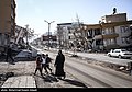
Gallery[edit]
-
 Collapsed house in Guari, Port Moresby
 -
 Cracked land in Namea, Sandaun
 -
 Ruins of multiple collapsed buildings in Angoram, East Sepik
 -
 A neighborhood in Wagumin
 -
 Destruction in Yawar, Madang
 -
 The collapsed Nip Apartment complex in Lae, where 302 people died
 -
 Destroyed mosque in Anglimp, Highlands


_01.jpg)

See also[edit]
References[edit]
- ^ Ref
- ^ Ref
- ^ Ref
- ^ Ref
- ^ Ref
- ^ Ref
- ^ Ref
- ^ Ref
- ^ Ref
- ^ Ref
- ^ Ref
- ^ Ref
- ^ Ref
- ^ Ref
- ^ Ref
- ^ Ref
- ^ Ref
- ^ Ref
- ^ Ref
- ^ Ref
- ^ Ref
- ^ Ref
- ^ Ref
- ^ Ref
- ^ Ref
- ^ Ref
- ^ Ref
- ^ Ref
- ^ Ref
- ^ Ref
- ^ Ref
- ^ Ref
- ^ Ref
- ^ Ref
- ^ Ref
- ^ Ref
- ^ Ref
- ^ Ref
- ^ Ref
- ^ Ref
- ^ Ref
- ^ Ref
- ^ Ref
- ^ Ref
- ^ Ref
- ^ Ref
- ^ Ref
- ^ Ref
- ^ Ref
- ^ Ref
- ^ Ref
- ^ Ref
- ^ Ref
- ^ Ref
- ^ Ref
- ^ Ref
- ^ Ref
- ^ Ref
- ^ Ref
- ^ Ref
- ^ Ref
- ^ Ref
- ^ Ref
- ^ Ref
- ^ Ref
- ^ Ref
- ^ Ref
- ^ Ref
- ^ Ref
- ^ Ref
- ^ Ref
- ^ Ref
- ^ Ref
- ^ Ref
- ^ Ref
- ^ Ref
- ^ Ref
- ^ Ref
- ^ Ref
- ^ Ref
- ^ Ref
- ^ Ref
- ^ Ref
- ^ Ref
- ^ Ref
- ^ Ref
- ^ Ref
- ^ Ref
- ^ Ref
- ^ Ref
- ^ Ref
- ^ Ref
- ^ Ref
- ^ Ref
- ^ Ref
- ^ Ref
- ^ Ref
- ^ Ref
- ^ Ref
- ^ Ref
- ^ Ref
- ^ Ref
- ^ Ref
- ^ Ref
- ^ Ref
- ^ Ref
- ^ Ref
- ^ Ref
- ^ Ref
- ^ Ref
- ^ Ref
- ^ Ref
- ^ Ref
- ^ Ref
- ^ Ref
- ^ Ref
- ^ Ref
- ^ Ref
- ^ Ref
- ^ Ref
- ^ Ref
- ^ Ref
- ^ Ref
- ^ Ref
- ^ Ref
- ^ Ref
- ^ Ref
- ^ Ref
- ^ Ref
- ^ Ref
- ^ Ref
- ^ Ref
- ^ Ref
- ^ Ref
- ^ Ref
- ^ Ref
- ^ Ref
- ^ Ref
- ^ Ref
- ^ Ref
- ^ Ref
- ^ Ref
- ^ Ref
- ^ Ref
- ^ Ref
- ^ Ref
- ^ Ref
- ^ Ref
- ^ Ref
- ^ Ref
- ^ Ref
- ^ Ref
- ^ Ref
- ^ Ref
- ^ Ref
- ^ Ref
- ^ Ref
- ^ Ref
- ^ Ref
- ^ Ref
- ^ Ref
- ^ Ref
- ^ Ref
- ^ Ref
- ^ Ref
- ^ Ref
- ^ Ref
- ^ Ref
- ^ Ref
- ^ Ref
- ^ Ref
- ^ Ref
- ^ Ref
- ^ Ref
- ^ Ref
- ^ Ref
- ^ Ref
- ^ Ref
- ^ Ref
- ^ Ref
- ^ Ref
- ^ Ref
- ^ Ref
- ^ Ref
- ^ Ref
- ^ Ref
- ^ Ref
- ^ Ref
- ^ Ref
- ^ Ref
- ^ Ref
- ^ Ref
- ^ Ref
- ^ Ref
- ^ Ref
- ^ Ref
- ^ Ref
- ^ Ref
- ^ Ref
- ^ Ref
- ^ Ref
- ^ Ref
- ^ Ref
- ^ Ref
- ^ Ref
- ^ Ref
- ^ Ref
- ^ Ref
- ^ Ref
- ^ Ref
- ^ Ref
- ^ Ref
- ^ Ref
- ^ Ref
- ^ Ref
- ^ Ref
- ^ Ref
- ^ Ref
- ^ Ref
- ^ Ref
- ^ Ref
- ^ Ref
- ^ Ref
- ^ Ref
- ^ Ref
- ^ Ref
- ^ Ref
- ^ Ref
- ^ Ref
- ^ Ref
- ^ Ref
- ^ Ref
- ^ Ref
- ^ Ref
- ^ Ref
- ^ Ref
- ^ Ref
- ^ Ref
- ^ Ref
- ^ Ref
- ^ Ref
- ^ Ref
- ^ Ref
- ^ Ref
- ^ Ref
- ^ Ref
- ^ Ref
- ^ Ref
- ^ Ref
- ^ Ref
- ^ Ref
- ^ Ref
- ^ Ref
- ^ Ref
- ^ Ref
- ^ Ref
- ^ Ref
- ^ Ref
- ^ Ref
- ^ Ref
- ^ Ref
- ^ Ref
- ^ Ref
- ^ Ref
- ^ Ref
- ^ Ref
- ^ Ref
- ^ Ref
- ^ Ref
- ^ Ref
- ^ Ref
- ^ Ref
- ^ Ref
- ^ Ref
- ^ Ref
- ^ Ref
- ^ Ref
- ^ Ref
- ^ Ref
- ^ Ref
- ^ Ref
- ^ Ref