Vladičin Han
Vladičin Han
Владичин Хан (Serbian) | |
|---|---|
Town and municipality | |
Vladičin Han | |
 Location of the municipality of Vladičin Han within Serbia | |
| Coordinates: 42°42′N 22°04′E / 42.700°N 22.067°E | |
| Country | |
| Region | Southern and Eastern Serbia |
| District | Pčinja |
| Settlements | 51 |
| Government | |
| • Mayor | Goran Mladenović (SNS) |
| Area | |
| • Town | 4.30 km2 (1.66 sq mi) |
| • Municipality | 366 km2 (141 sq mi) |
| Elevation | 386 m (1,266 ft) |
| Population (2022 census)[2] | |
| • Town | 7,343 |
| • Town density | 1,700/km2 (4,400/sq mi) |
| • Municipality | 17,532 |
| • Municipality density | 48/km2 (120/sq mi) |
| Time zone | UTC+1 (CET) |
| • Summer (DST) | UTC+2 (CEST) |
| Postal code | 17510 |
| Area code | +381(0)17 |
| Car plates | VR |
| Website | www |
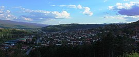
Vladičin Han (Serbian Cyrillic: Владичин Хан, pronounced [ʋlǎdit͡ʃiŋ xâːn])[3] is a town and municipality located in the Pčinja District of southern Serbia. As of 2022, the population of the town is 7,343, while the population of the municipality is 17,532.
History
[edit]From 1929 to 1941, Vladičin Han was part of the Vardar Banovina of the Kingdom of Yugoslavia.
Settlements
[edit]
Aside from the town of Vladičin Han, the municipality includes the following settlements:
- Balinovce
- Bačvište
- Belanovce
- Beliševo
- Bogoševo
- Brestovo
- Dekutince
- Donje Jabukovo
- Dupljane
- Džep
- Garinje
- Gornje Jabukovo
- Gramađe
- Jagnjilo
- Jastrebac
- Jovac
- Kalimance
- Kacapun
- Koznica
- Kopitarce
- Kostomlatica
- Kržince
- Kukavica
- Kunovo
- Lebet
- Lepenica
- Letovište
- Ljutež
- Mazarać
- Manajle
- Manjak
- Mrtvica
- Ostrovica
- Polom
- Prekodolce
- Priboj
- Ravna Reka
- Rdovo
- Repince
- Repište
- Ružić
- Solačka Sena
- Srneći Dol
- Stubal
- Suva Morava
- Tegovište
- Urvič
- Vrbovo
- Zebince
- Žitorađe
Demographics
[edit]| Year | Pop. | ±% p.a. |
|---|---|---|
| 1948 | 24,946 | — |
| 1953 | 25,927 | +0.77% |
| 1961 | 26,074 | +0.07% |
| 1971 | 25,231 | −0.33% |
| 1981 | 25,441 | +0.08% |
| 1991 | 25,225 | −0.09% |
| 2002 | 23,703 | −0.56% |
| 2011 | 20,871 | −1.40% |
| 2022 | 17,532 | −1.57% |
| Source: [4] | ||
According to the 2011 census results, the municipality of Vladičin Han has a population of 20,871 inhabitants.
Ethnic groups
[edit]The ethnic composition of the municipality:[5]
| Ethnic group | Population | % |
|---|---|---|
| Serbs | 18,644 | 89.33% |
| Romani | 1,503 | 7.20% |
| Bulgarians | 88 | 0.42% |
| Macedonians | 23 | 0.11% |
| Russians | 10 | 0.05% |
| Others | 603 | 2.89% |
| Total | 20,871 |
Economy
[edit]The following table gives a preview of the total number of registered people employed in legal entities per their core activity (as of 2018):[6]
| Activity | Total |
|---|---|
| Agriculture, forestry and fishing | 71 |
| Mining and quarrying | - |
| Manufacturing | 1451 |
| Electricity, gas, steam and air conditioning supply | 221 |
| Water supply; sewerage, waste management and remediation activities | 123 |
| Construction | 276 |
| Wholesale and retail trade, repair of motor vehicles and motorcycles | 394 |
| Transportation and storage | 283 |
| Accommodation and food services | 193 |
| Information and communication | 14 |
| Financial and insurance activities | 18 |
| Real estate activities | - |
| Professional, scientific and technical activities | 89 |
| Administrative and support service activities | 59 |
| Public administration and defense; compulsory social security | 235 |
| Education | 332 |
| Human health and social work activities | 179 |
| Arts, entertainment and recreation | 43 |
| Other service activities | 52 |
| Individual agricultural workers | 9 |
| Total | 3,844 |
Gallery
[edit]-
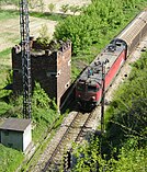
Vladičin Han railway station
-
Vrla River
-
Jovačko Lake
-
Destroyed highway bridge during the 1999 NATO bombing
See also
[edit]References
[edit]- ^ "Municipalities of Serbia, 2006". Statistical Office of Serbia. Retrieved 2010-11-28.
- ^ "Census 2022: Total population, by municipalities and cities". popis2022.stat.gov.rs.
- ^ Vladičin / Владичин pronounced in isolation: [ʋlǎdit͡ʃin].
- ^ "2011 Census of Population, Households and Dwellings in the Republic of Serbia" (PDF). stat.gov.rs. Statistical Office of the Republic of Serbia. Retrieved 11 January 2017.
- ^ "Попис становништва, домаћинстава и станова 2011. у Републици Србији" (PDF). stat.gov.rs. Republički zavod za statistiku. Retrieved 15 January 2017.
- ^ "MUNICIPALITIES AND REGIONS OF THE REPUBLIC OF SERBIA, 2019" (PDF). stat.gov.rs. Statistical Office of the Republic of Serbia. 25 December 2019. Retrieved 28 December 2019.
External links
[edit]


